
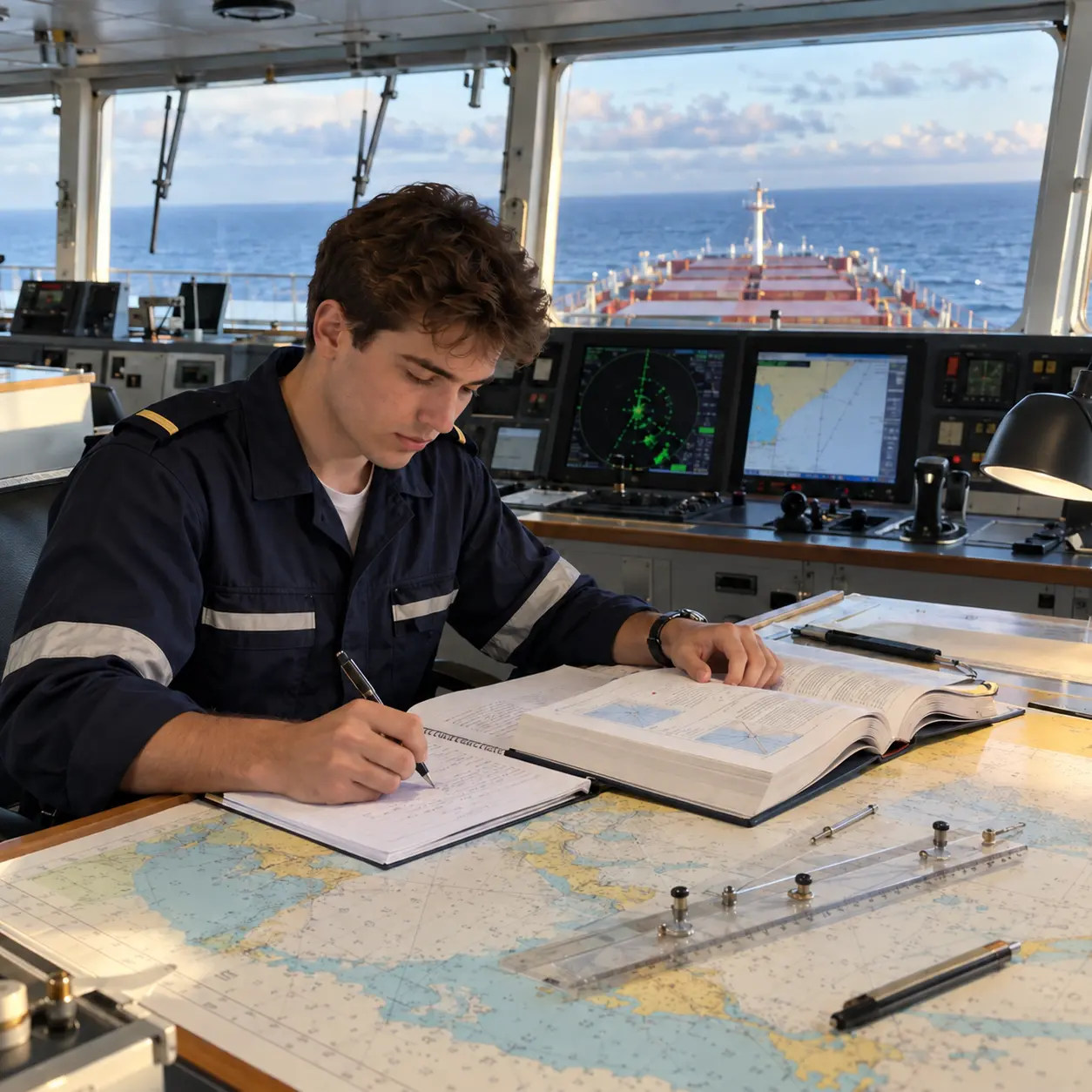
A study guide for commercial-ship deck cadets, third officers, maritime students and lecturers
National information checked: 2 November 2026
A third navigation officer does much more than read a chart or recognise a navigation light. The officer must be able to keep a safe bridge watch, apply the collision regulations, monitor the ship’s position, communicate with the master and bridge team, understand cargo operations, respond to emergencies and help protect people and the marine environment.
The examination route depends on the country that issues the certificate. In Italy, the relevant operational certificate is commonly called Ufficiale di coperta. In the United Kingdom, it is the Officer of the Watch, unlimited certificate. India uses Second Mate (Foreign Going) for an operational navigational-watch qualification. The United States has a national Third Mate endorsement. These names are not identical, and a national certificate should not be treated as automatically valid in another country.
This guide explains the international framework, compares examination systems in eleven countries and provides a large collection of original study questions. It is written for candidates on commercial seagoing ships, not military vessels, pleasure craft or fishing vessels, although some general principles may also be useful elsewhere.
Important study note: The questions and model answers in this article were written for education. They are not claimed to be official past-examination questions or questions known to have been asked in a named country. Country-labelled examples illustrate the kind of competence a student can practise. The official links provide national syllabuses and, where available, authentic specimen papers. Assessment formats, legislation, eligibility and dates change, so check the latest requirements with the relevant authority and approved training provider. For actual navigation, use the current rules, charts, approved passage plan, company procedures and the master’s orders.
Collision-avoidance note: A real situation depends on visibility, vessel status, risk of collision, local rules, traffic, available sea room and many other factors. The examples below explain principles; they are not directions for a real ship to turn in a particular direction without assessing the full situation.
Contents
- What is a third officer?
- STCW and the navigation-watchkeeping certificate
- Written, oral, simulator and practical assessments
- Examination systems in eleven countries
- How to answer written and oral questions
- Written examination questions and model answers
- Worked navigation, stability and cargo calculations
- Oral examination questions and model answers
- Scenario-based oral examination practice
- Multiple-choice practice examination and answer key
- An eight-week study plan
- Examination preparation checklist
- Glossary for maritime students
- Official references and further reading
1. What is a third officer on a commercial ship?
A third officer, also called a third mate in some fleets, is generally a junior deck officer. The precise rank structure varies. Some companies also employ a fourth officer, while others use third officer as the first deck-officer rank after cadetship.
A qualified third officer may be assigned to:
- Keep a navigational watch under the master’s overall command.
- Monitor the ship’s position, course, speed, traffic and navigational hazards.
- Apply the International Regulations for Preventing Collisions at Sea, known as COLREGs.
- Use radar, ARPA, ECDIS, GNSS, echo sounders and other available equipment appropriately.
- Participate in passage planning, bridge procedures and navigational records as assigned.
- Assist with cargo watches, mooring, anchoring and shipboard operations within the officer’s competence.
- Help inspect and maintain life-saving and firefighting equipment when these duties are allocated to the officer.
- Participate in drills, security, pollution prevention and emergency response.
The ship’s actual allocation of responsibilities depends on the company, the master, the chief officer, the safe manning document and the officer’s certificate and endorsements. For example, life-saving appliance maintenance is often assigned to a third officer, but that allocation is not universal.
Shipboard rank and certificate are different
| Term | Meaning |
|---|---|
| Third officer / third mate | A shipboard rank or job title. |
| Officer of the Watch (OOW) | A commonly used title for an officer responsible for a navigational watch. |
| Officer in Charge of a Navigational Watch (OIC-NW or OICNW) | A description used for the operational watchkeeping function in the STCW system. |
| Certificate of Competency (CoC) | A certificate issued by an administration for specified functions, limitations and conditions. |
| Endorsement | An official statement concerning the certificate, its functions, limitations or recognition, depending on national rules. |
| Master and chief mate | Senior deck roles normally associated with management-level responsibilities and qualifications. |
A CoC is not the same as an employment contract. A person may hold an operational watchkeeping certificate and sail in a different company rank, provided the ship’s flag-State, manning and company requirements are met. Recognition by another flag State under STCW Regulation I/10, where applicable, may require a separate endorsement.
2. The international foundation: STCW Regulation II/1
The International Convention on Standards of Training, Certification and Watchkeeping for Seafarers, or STCW, establishes international standards for seafarer training and certification. Chapter II addresses the master and deck department. For an officer in charge of a navigational watch on a seagoing ship of 500 gross tonnage or more, the central operational-level reference is STCW Regulation II/1 and the related competence standards in Section A-II/1, especially Table A-II/1.
STCW sets minimum standards of competence. It does not create one common worldwide question paper. National administrations implement the Convention and determine their approved training, assessment and certification processes. The relevant rules also depend on the Convention’s scope, any applicable exceptions, voyage and certificate limitations and national implementation. See the IMO’s STCW overview.
Three broad operational-level functions
| STCW function | Typical subjects for a candidate |
|---|---|
| Navigation | Passage planning, position fixing, chartwork, radar and ARPA, ECDIS, compass, meteorology, bridge watchkeeping, COLREGs, manoeuvring and responding to emergencies. |
| Cargo handling and stowage | Safe cargo operations, stowage and securing, inspection of cargo spaces and awareness of cargo-related hazards. |
| Controlling ship operations and care for persons on board | Basic stability and construction, pollution prevention, fire prevention and firefighting, life-saving appliances, first aid, safety, security and leadership. |
A question can assess several functions at the same time. A grounding scenario, for example, may require navigation, communication, emergency response, basic stability, pollution prevention and recordkeeping.
What else may be required?
A candidate can be required to complete approved education and training, supervised sea service, a training record book, medical and eyesight checks, practical demonstrations and relevant safety courses. Radio qualifications, tanker training, ECDIS training, security duties and other endorsements depend on the candidate’s duties, ship and national rules.
Do not assume that passing the oral examination alone grants the certificate, or that every country requires exactly the same number of examination papers or months of sea service.
3. Written, oral, simulator and practical assessments
| Assessment | What the student may do | What is being assessed |
|---|---|---|
| Written or digital | Answer multiple-choice or structured questions, calculate position, work a tide or stability problem, or interpret a chart. | Knowledge, correct methods, calculations and understanding of applicable rules. |
| Oral | Explain the rule, describe the action in a developing situation or answer follow-up questions. | Judgement, priorities, communication, practical understanding and safe decisions. |
| Simulator | Conduct a bridge watch, use radar or ECDIS, assess traffic and respond to failures or emergencies. | Application of knowledge, teamwork, situational awareness and operational performance. |
| Practical assessment | Demonstrate equipment checks, navigational plotting, safety procedures or another assigned task. | Ability to perform tasks safely and correctly. |
| Approved course and onboard training | Complete lessons, documented tasks, supervised watches and a training record book. | Development of knowledge and practical competence over time. |
A country may combine these methods or conduct them at different stages. A simulator session can be part of an approved course, a practical assessment or a separate national examination. An oral examination is not necessarily present in the same form in every national route.
Example: a written question and an oral follow-up
Written question: Explain the main stages of passage planning.
Short model answer: Appraise all relevant information, plan the berth-to-berth voyage, execute the approved plan and monitor the vessel’s progress continuously. The plan should consider charted hazards, traffic, weather, tides, under-keel clearance, reporting requirements and contingency arrangements.
Oral follow-up: You are on watch and the ship is approaching a waypoint in poor visibility. What would you do?
Short model answer: Maintain a proper lookout and safe speed, check the vessel’s position by suitable independent means where available, assess traffic and hazards, and follow the approved plan and master’s standing orders. Call the master and obtain additional bridge support when required or when in doubt. Prepare the course alteration, verify that it is safe, communicate clearly with the bridge team and monitor the ship’s response. Apply the rules relevant to the actual visibility and traffic situation.
4. Navigation-officer examinations in different countries
The following table provides orientation, not a legal equivalence decision. Actual privileges depend on the particular certificate, tonnage and voyage limitations, endorsements, flag State, training and any applicable national recognition.
| Country | Relevant operational-level title or route | Published assessment approach | Main authority |
|---|---|---|---|
| Italy | Ufficiale di coperta | The Italian decree requires a theoretical-practical competence examination; the competent authority and current programme determine how it is administered. | Ministry of Infrastructure and Transport / Capitaneria di Porto |
| United Kingdom | Officer of the Watch, unlimited, II/1 | Relevant written or modernised digital assessments and a two-part MCA OOW examination process with computer-based Part A and oral Part B; transitional rules apply. | Maritime and Coastguard Agency, MCA |
| India | Second Mate, Foreign Going | DGS materials describe written and oral assessment; training, simulator and other components depend on the applicable route. | Directorate General of Shipping, DGS |
| Philippines | Officer in Charge of a Navigational Watch, OIC-NW | MARINA documents identify deck operational-level theoretical examination and practical assessment. | Maritime Industry Authority, MARINA |
| United States | Third Mate, unlimited national endorsement; STCW OICNW as applicable | USCG publishes national examination modules and specimen papers; assessment requirements depend on the credential. | US Coast Guard National Maritime Center |
| Canada | Watchkeeping Mate | Canadian regulations identify examinations in navigation, cargo and other subjects, a simulator component and an oral examination on general seamanship for the specified route. | Transport Canada |
| Australia | Watchkeeper Deck, STCW II/1 | Approved training and service plus an AMSA oral examination; course and other assessments depend on the route. | Australian Maritime Safety Authority, AMSA |
| New Zealand | Watchkeeper Deck | Approved training and service and a final examination; Maritime NZ describes its final examination generally as oral. | Maritime New Zealand |
| South Africa | Officer of the Watch, deck, II/1 | SAMSA publishes a deck officer oral-assessment guideline; other academic and practical assessments depend on the route. | South African Maritime Safety Authority, SAMSA |
| Singapore | Deck Officer Class 3 | MPA describes an oral and simulator component for the Class 3 examination; approved course assessments and current requirements should also be checked. | Maritime and Port Authority of Singapore, MPA |
| Pakistan | Deck Officer Class III or IV, depending on the route and limitations | Published material identifies written, oral and signalling categories; a historical notice relates Class III/IV candidates to II/1. Confirm the current classification and syllabus. | Mercantile Marine Department |
4.1 Italy: Ufficiale di coperta
Italy’s Decree No. 72 of 7 May 2025, Article 5, identifies the Ufficiale di coperta as an operational-level officer responsible for a navigational watch. The decree describes training, sea-service and certificate requirements and requires a theoretical-practical examination to demonstrate the relevant competence. It also addresses certain training limitations and radio duties. The Italian maritime labour portal lists Decree No. 76 of 9 May 2025 for the relevant STCW examination programmes.
A theoretical-practical examination should not automatically be described as a fixed, separate written paper plus oral paper for every session. Ask the competent Capitaneria and training institution for the applicable programme, language, session and assessment procedure.
Original practice questions:
- Technical: Explain the responsibilities of the officer of the watch when a pilot is on board.
- Scenario: A target appears on radar in restricted visibility. How would you assess the risk and prepare your response?
Answer direction: A pilot provides specialist advice, but the master and bridge team retain their responsibilities. In restricted visibility, maintain a proper lookout and safe speed, evaluate the target using all available means and apply the COLREGs relevant to vessels not in sight, particularly Rule 19 when applicable.
Sources: Italian Decree 72/2025; Italian examination programmes.
4.2 United Kingdom: Officer of the Watch, unlimited
The MCA publishes a deck oral-examination syllabus and a modernised operational-level assessment syllabus. Under the MCA guidance available on 2 November 2026, new OOW unlimited course starters from August 2025 follow the modernised syllabus and take the relevant digital assessment in Navigation, Stability and Operations. Older routes and specified exemptions have transitional arrangements.
The MCA describes the OOW unlimited examination process as Part A, an online, computer-based, proctored assessment, and Part B, an online oral examination. These parts should not be confused with the separate route-dependent operational-level academic or digital assessment. Always check the latest MCA instructions and your notice of eligibility.
Original practice questions:
- Written/digital-style: Explain the difference between a ship’s heading, course over ground and track made good.
- Oral: Two power-driven vessels are in sight and crossing with risk of collision. What information is needed before deciding which rules apply?
Answer direction: Establish vessel type and status, relative bearing and movement, risk of collision, sea room and any special circumstances. Apply the relevant COLREGs rather than assuming that one rule resolves every traffic situation.
Sources: MCA modernised qualifications; MCA oral examination process; deck oral syllabus.
4.3 India: Second Mate, Foreign Going
India’s Second Mate (Foreign Going) qualification relates to the operational navigational-watch function under STCW II/1. The certificate title does not mean that every holder must be employed on board under the rank name “second officer”. DGS publishes examination and syllabus information for nautical grades, including the Second Mate (FG) oral syllabus and examination formats.
DGS Circular 07 of 2026 describes a structured oral-examination preparatory programme. It says participation is ordinarily voluntary and recommendatory, but may be made mandatory for candidates with poor oral-examination performance after multiple attempts. This programme prepares candidates for the statutory examination; it is not itself the examination. Check the latest DGS instructions, notices and the candidate’s approved course requirements.
Original practice questions:
- Written: A ship travels 96 nautical miles at an average speed over ground of 12 knots. How long does the passage take? Answer: 8 hours.
- Oral: Explain your responsibilities when approaching a traffic separation scheme in reduced visibility.
Answer direction: Review the route and reporting requirements, assess traffic, comply with the applicable COLREGs including Rule 10 where relevant, ensure safe speed and lookout, and apply Rule 19 if vessels are not in sight in or near restricted visibility.
Sources: DGS examination and certification information; DGS Circular 07/2026.
4.4 Philippines: Officer in Charge of a Navigational Watch
MARINA uses the title Officer in Charge of a Navigational Watch, or OIC-NW, for the relevant deck operational-level function. MARINA’s certification documentation refers to passing the theoretical examination for deck operational level and the practical assessment for deck operational level, along with the applicable supporting requirements.
Candidates should verify the current MARINA process, education requirements, assessment provider, simulator use and relevant circulars. Do not assume that the practical assessment is identical to the MCA’s final oral examination or that all candidates follow the same route.
Original practice questions:
- Theory: What is the difference between a radar target’s bearing and its range?
- Practical: Demonstrate how you would monitor a vessel on radar and communicate a developing close-quarters risk to the bridge team.
Answer direction: Bearing identifies direction and range identifies distance. Assess changes over time, use radar plotting or ARPA correctly, verify the information with all available means and take action appropriate to the actual rules and situation.
Source: MARINA deck officer certification circular and documentary requirements.
4.5 United States: Third Mate
The US Coast Guard National Maritime Center publishes Third Mate, unlimited national examination modules. The Coast Guard’s ocean and near-coastal listing includes navigation rules, deck general knowledge, deck safety, navigation and chart-plotting subjects. Applicable modules vary with the endorsement and route.
A US national endorsement and an STCW endorsement are related but separate components of credentialing. Requirements must be checked for the planned service. Do not assume that the US route necessarily has the same final oral examination as the UK or Australia.
The USCG also publishes actual sample examinations, including an August 2026 Q114 Navigation General—Oceans specimen for second/third mate unlimited candidates. These are useful primary study resources; check the current USCG examination page for the latest version and module selection.
Original practice questions:
- Multiple-choice style: What information does a nautical chart datum provide? Answer direction: It is the reference level to which charted depths are related; the specific datum is identified on the chart.
- Application: Explain the difference between international COLREGs and any applicable US Inland Navigation Rules. Answer direction: Determine which set applies in the waters concerned and study the differences rather than assuming the rules are identical everywhere.
Sources: USCG deck examination modules; USCG Q114 sample examination; US navigation rules.
4.6 Canada: Watchkeeping Mate
Canada’s Watchkeeping Mate route is a relevant operational watchkeeping qualification. It is distinct from the separately named Watchkeeping Mate, Near Coastal certificate, which has different limitations. Canada’s Marine Personnel Regulations, section 134, list assessment subjects including communications, chartwork and pilotage, navigation safety, meteorology, ship construction and stability, cargo, general ship knowledge and simulator assessment. The listed Watchkeeping Mate route includes celestial navigation and an oral examination on general seamanship, subject to the applicable regulations and updates.
Original practice questions:
- Written: Calculate the ship’s under-keel clearance using a stated charted depth, height of tide, draught and squat allowance.
- Oral: What would you do if the ship’s anchor appeared to be dragging?
Answer direction: Verify the position trend with available means, alert the master, prepare engines and crew as ordered, warn relevant traffic where appropriate and monitor the vessel continuously. Any manoeuvre must reflect the available sea room and the master’s orders.
Sources: Canadian Marine Personnel Regulations, section 134; Transport Canada examination and certification publication.
4.7 Australia: Watchkeeper Deck
AMSA’s Watchkeeper Deck, STCW II/1, is an officer-level certificate. The published route includes medical, course and sea-service requirements and an AMSA oral examination. Approved training can include written, practical and simulator assessments; the exact pattern depends on the approved programme and pathway.
Original practice questions:
- Course assessment: Describe the sources of error that can affect a GNSS position.
- Oral: Your echo sounder shows rapidly decreasing depth. What are your priorities?
Answer direction: Treat the change seriously, check the position and depth indications against the passage plan and other available information, alert the master immediately, assess the risk of grounding and take appropriate immediate action within your authority and the ship’s procedures.
Sources: AMSA Watchkeeper Deck; AMSA oral exam preparation.
4.8 New Zealand: Watchkeeper Deck
Maritime New Zealand’s Watchkeeper Deck guidance states that the certificate corresponds to STCW II/1 and describes the related training and sea-service pathways. Maritime NZ’s general training guidance describes the final examination as oral, based on the competencies relevant to the certificate.
Original practice questions:
- Course assessment: Explain the use and limitations of ECDIS safety settings.
- Oral: What would you do if the steering failed while the ship was approaching a narrow channel?
Answer direction: Call the master and inform the engine room immediately; alert nearby traffic as appropriate, follow the steering-failure and bridge emergency procedures, prepare for alternative steering and assess the immediate navigational risk.
Sources: Maritime NZ Watchkeeper Deck guidance; Maritime NZ training and final examinations.
4.9 South Africa: Officer of the Watch
SAMSA publishes a deck officer oral-assessment syllabus that includes the Officer of the Watch. The guideline is useful for reviewing operational navigation, seamanship, safety and related knowledge. It is an older document, so candidates should confirm the current edition and their other examination and training requirements with SAMSA.
Original practice questions:
- Technical: Explain the difference between relative wind and true wind.
- Oral: You hear a fog signal apparently forward of the beam. What should you consider?
Answer direction: Establish the circumstances, maintain a proper lookout, assess collision risk and comply with the applicable restricted-visibility provisions. Rule 19 contains specific requirements concerning a fog signal apparently forward of the beam when the stated conditions apply.
Source: SAMSA deck officer oral-assessment syllabus guideline.
4.10 Singapore: Deck Officer Class 3
Singapore uses numbered deck-officer certificates. MPA identifies CoC Class 3 Deck Officer and has described its examination as including both oral and simulator components. Approved course assessments and detailed eligibility requirements should be checked directly with MPA and the training provider; the available MPA statement does not establish one identical written paper for every route.
Original practice questions:
- Simulator: Maintain a safe watch in heavy traffic while monitoring a planned route and communicating with the bridge team.
- Oral: Explain how you would use radar and visual observations together to evaluate a potential collision risk.
Answer direction: Use suitable ranges and plotting or ARPA, check target bearing and range trends, maintain a visual and audible lookout, consider equipment limitations and take action under the rules applicable to the circumstances.
Sources: MPA description of Class 3 oral and simulator examinations; MPA crewing and certification overview.
4.11 Pakistan: Deck Officer Class III or IV
Pakistan’s published fee schedule identifies Class III and Class IV deck-officer written and oral or signalling examination categories. A historical 2022–2023 examination notice refers to Class III and/or Class IV candidates under STCW II/1. Because that notice is historical and the exact certificate privileges differ, applicants should obtain the current syllabus, eligibility, limitations and exam schedule from the Mercantile Marine Department.
Original practice questions:
- Written: Explain the function of a voyage plan’s no-go areas and wheel-over positions.
- Oral: What information should be exchanged between the master and pilot before entering port?
Answer direction: Discuss the intended route, manoeuvring characteristics, draught and clearance, tug arrangements, traffic, communication, expected manoeuvres, contingencies and any local restrictions.
Sources: Pakistan examination categories; historical Class III/IV examination notice.
5. How to answer navigation examination questions
5.1 For a written technical question
Use a clear structure:
- Define the term or identify the purpose of the equipment.
- Explain its operating principle or relevant rule.
- Describe the practical application.
- State important limitations, checks and safety precautions.
- Use a labelled sketch, calculation or example when the question requests it.
5.2 For a collision-avoidance or emergency question
A helpful sequence is:
Look out and assess → identify the applicable rules and hazards → call or inform the appropriate people → take timely action → monitor the result → record and report as required.
These actions can happen together. If immediate action is needed to prevent danger, do not delay it merely to complete an oral-answer formula. Do not state that calling the master transfers the watch: the OOW remains responsible until properly relieved or the master has clearly taken over and this is mutually understood.
5.3 Questions an examiner may ask next
- “What makes you think a risk of collision exists?”
- “Is the other vessel actually in sight, or only a radar target?”
- “Which rule applies, and what are its conditions?”
- “What would you do if your first action was ineffective?”
- “When would you call the master?”
- “How would you confirm the ship’s position independently?”
- “What are the limits of the equipment you are using?”
- “How would you communicate your decision to the bridge team?”
A safe, reasoned explanation is more useful than memorising a sentence such as “always turn to starboard”. The correct response depends on the rule and the actual circumstances.
6. Written examination practice: questions and model answers
These questions are original teaching material. Depending on the examination, a candidate may need a longer answer, a drawing, a chart or a reference to a specific regulation.
Written question 1: Explain the four stages of passage planning.
Model answer: The stages are appraisal, planning, execution and monitoring. During appraisal, the bridge team gathers charts, publications, weather, tide, navigational warnings, vessel characteristics and other relevant information. During planning, it prepares a safe berth-to-berth route with courses, waypoints, no-go areas, clearances and contingencies. The master approves the plan. During execution, the team carries it out in the prevailing conditions. During monitoring, it repeatedly checks position, traffic, progress and hazards, adjusting the plan when authorised and necessary.
Written question 2: Describe a proper bridge watch.
Model answer: A proper watch includes a continuous lookout by sight and hearing and all available means appropriate to the conditions. The OOW monitors position, traffic, weather, the ship’s course and speed, machinery status where relevant, navigational equipment and the passage plan. The OOW follows the COLREGs, the master’s orders and the safety management system, calls for assistance early and records relevant events. The watch arrangement must reflect traffic, visibility, workload, fatigue and other risks.
Written question 3: Explain the difference between heading, course and track.
Model answer: Heading is the direction in which the ship’s bow points. Course is a direction intended or steered, depending on the context. Course over ground (COG) is the direction of movement over the earth’s surface. The track is the path actually followed or intended, depending on how the word is qualified. Wind, current, steering and other effects can cause heading and COG to differ. State clearly which quantity is being used.
Written question 4: What is the difference between speed through the water and speed over the ground?
Model answer: Speed through the water is the ship’s movement relative to the surrounding water. Speed over the ground is movement relative to the earth. Current can make the two different in both speed and direction. A speed log and GNSS may measure or calculate different quantities and each has limitations. Check the equipment input and the quantity required for the calculation.
Written question 5: Explain how radar helps prevent collisions.
Model answer: Radar can display the range and bearing of detected objects, including targets that may not be visible by eye. Systematic observation, radar plotting or ARPA can help estimate a target’s movement and closest approach. The OOW must consider tuning, sea clutter, rain, blind sectors, small-target detection, input errors and plotting limitations. Radar supports but does not replace a proper lookout or compliance with the COLREGs.
Written question 6: Explain the purpose and limitations of ARPA.
Model answer: Automatic Radar Plotting Aid, or ARPA, tracks suitable radar targets and estimates information such as course, speed, closest point of approach and time to closest point of approach. Its predictions depend on target acquisition, sensor inputs, the tracking algorithm and the assumption of continued motion. They can become unreliable after a manoeuvre, poor tracking or incorrect speed and heading inputs. The OOW should cross-check target trends and understand the display’s settings.
Written question 7: What is ECDIS and why do safety settings matter?
Model answer: An Electronic Chart Display and Information System, or ECDIS, is an approved navigational information system that can display official electronic navigational chart data with vessel position and other information. Appropriate safety settings, chart updates, scale, route checking and alarm management help the bridge team identify hazards. Wrong settings, poor-quality data, incorrect sensor inputs or overreliance on the display can hide danger. Use an approved back-up arrangement and other position checks as required.
Written question 8: Describe how risk of collision can be assessed.
Model answer: Use all available means appropriate to the circumstances, including visual bearings, radar, radar plotting or ARPA, sound and other relevant information. A compass bearing that does not change appreciably while range decreases can indicate a risk of collision, although risk can exist even with a changing bearing, especially close to a large vessel, tow or target at short range. If in doubt, risk is deemed to exist under Rule 7. AIS is supplementary and must not be the only basis for the assessment.
Written question 9: Explain the roles of the give-way and stand-on vessels.
Model answer: Where the rules concerning vessels in sight apply and one vessel is required to keep out of the way, the give-way vessel should take early and substantial action to keep well clear. The stand-on vessel generally maintains course and speed initially, but Rule 17 permits and in some circumstances requires action when the give-way vessel is not taking appropriate action or collision cannot otherwise be avoided. The exact action depends on all applicable rules and circumstances. Rule 19 has a different framework for vessels not in sight in or near restricted visibility.
Written question 10: Explain the difference between IALA Regions A and B.
Model answer: The maritime buoyage system uses two regions with a difference in the colours of lateral marks. In the conventional direction of buoyage, Region A normally uses red for port-hand marks and green for starboard-hand marks; Region B normally uses green for port-hand marks and red for starboard-hand marks. The conventional direction is defined by the relevant authority and must not simply be guessed. Cardinal and other mark types have their own meanings. Consult current local publications and the actual chart.
Written question 11: What is under-keel clearance?
Model answer: Under-keel clearance is the vertical clearance between the ship’s keel and the seabed. It depends on the water depth at the ship’s position and time, the vessel’s deepest relevant draught and dynamic effects such as squat, wave response, heel, water density and measurement uncertainties. A planned clearance must meet the ship’s and port’s applicable criteria. The simple static calculation is only a starting point.
Written question 12: Explain what squat is.
Model answer: Squat is a dynamic change in a ship’s sinkage and trim when it moves through water, particularly in shallow or confined conditions. It generally increases with speed and is affected by hull form, water depth, channel width and other factors. It can reduce under-keel clearance. The master and bridge team must use the vessel’s approved guidance, pilot information and company procedures; a single simplified formula is not universally accurate.
Written question 13: Describe the checks when taking over a navigational watch.
Model answer: Review the ship’s position, course, speed, passage plan, next alterations, traffic, weather, visibility, water depth and navigational warnings. Check the status and settings of radar, ECDIS, compass, alarms and other equipment; review the master’s orders, bridge staffing, communications, machinery condition and any defects. Confirm relevant events and ongoing operations with the outgoing OOW. Do not take over while an essential point is unclear or the watch cannot be accepted safely.
Written question 14: Explain the duties of the bridge team when a pilot is on board.
Model answer: Carry out the master–pilot information exchange, agree the plan and communication arrangements, monitor the ship’s position and progress and check that orders are understood and executed. The pilot provides local expertise, while the master and bridge officers retain responsibility for the safety of the ship. If there is doubt about an instruction or the ship’s safety, question it promptly and inform the master.
Written question 15: Explain the purpose of the International Maritime Dangerous Goods Code.
Model answer: The IMDG Code provides requirements for the safe carriage of dangerous goods in packaged form by sea, including classification, identification, marking, documentation, stowage and segregation as applicable. It is mandatory under the relevant SOLAS and MARPOL provisions, subject to their application and current amendments. Officers must use the current code, the ship’s documents and company procedures; a container label alone is not a complete cargo assessment.
Written question 16: Explain what the free-surface effect is.
Model answer: Liquid in a partially filled tank can move as the ship heels. This movement produces a free-surface effect that reduces the ship’s effective initial stability. The effect depends on the tank, liquid and level; it is assessed using the approved stability information. Do not assume every tank has the same effect or that a simple volume calculation is sufficient for a loading decision.
Written question 17: Explain the purpose of the GMDSS.
Model answer: The Global Maritime Distress and Safety System is an internationally established framework for distress and safety communications. It uses suitable communication equipment and services according to the ship’s arrangements, operating area and applicable requirements. An officer should know the ship’s procedures, assigned radio responsibilities and required qualifications. A false distress alert must be cancelled in accordance with the relevant instructions.
Written question 18: Describe the immediate priorities after a person falls overboard.
Model answer: Raise the alarm, keep the person in sight, mark the position using the appropriate equipment, deploy a suitable lifebuoy if safe and notify the master. Follow the ship’s man-overboard procedure, call additional bridge personnel and prepare rescue equipment. The master or responsible officer selects a recovery manoeuvre considering the vessel, weather, traffic and position of the person. Initiate distress or urgency communications when appropriate.
7. Worked navigation, stability and cargo calculations
The examples use simplified assumptions for study. In practice, use current official data, verified instrument inputs and the ship’s approved procedures. Show the formula, units, working and answer.
Calculation 1: Distance, speed and time
Question: A ship travels 96 nautical miles at a constant speed over ground of 12 knots. How long will it take?
Time = distance ÷ speed = 96 ÷ 12 = 8 hours.
A knot is one nautical mile per hour. Real voyages may involve speed changes, current and manoeuvring delays.
Calculation 2: Estimated time of arrival and date
Question: A ship leaves at 18:30 UTC on Monday. The remaining distance is 84 nautical miles and the expected constant speed over ground is 12 knots. Find the ETA in UTC and in a port using UTC + 2 hours.
Time = 84 ÷ 12 = 7 hours.
18:30 Monday + 7 hours = 01:30 UTC Tuesday.
Port time = 01:30 + 2 hours = 03:30 Tuesday.
In practice, verify the local time zone and any seasonal or administrative changes for the arrival date.
Calculation 3: Difference in latitude
Question: A vessel sails due north along a meridian from 36°20.0′ N to 37°05.0′ N. Estimate the distance.
The change in latitude is 45.0 minutes of arc. For basic navigation, one minute of latitude is approximately one nautical mile, so the distance is approximately 45 nautical miles. This simple example assumes a meridional track and ignores current and ellipsoidal refinements.
Calculation 4: Compass, deviation and variation
Question: Compass heading is 086°. Deviation is 2° E and variation is 5° W. Calculate true heading using east as positive and west as negative.
Magnetic heading = compass heading + deviation = 086° + 2° = 088° M.
True heading = magnetic heading + variation = 088° − 5° = 083° T.
Use the correct deviation for the ship’s heading and the current charted variation, including any applicable annual change.
Calculation 5: Gyro error
Question: True heading is 120.0° and gyro error is 1.5° E. What should the gyro heading be, using the convention true = gyro + easterly error?
Gyro heading = 120.0° − 1.5° = 118.5° gyro.
Different publications may describe error with different wording. Always identify the sign convention and check the result against the observed true and gyro bearings.
Calculation 6: Simplified under-keel clearance
Question: The charted depth is 15.0 m, height of tide above chart datum is 2.0 m, deepest draught is 14.2 m and the estimated squat allowance is 0.7 m. Find the remaining clearance before other allowances.
Available depth = 15.0 + 2.0 = 17.0 m.
Clearance = 17.0 − 14.2 − 0.7 = 2.1 m.
This does not include wave response, heel, density, chart or sounding uncertainty, other dynamic factors or the required company/port safety margin. It is not sufficient by itself to approve a real passage.
Calculation 7: Simple tide interpolation for arithmetic practice
Question: Assume the height of tide rises at a constant rate from 1.2 m at 12:00 to 4.2 m at 18:00. Estimate the height at 14:00.
Rise over six hours = 4.2 − 1.2 = 3.0 m.
Two hours is one-third of six hours. Assumed rise = 3.0 ÷ 3 = 1.0 m.
Estimated height = 1.2 + 1.0 = 2.2 m.
Important: Real tidal curves are not generally linear. This is an arithmetic exercise only. For operations, use approved tide tables, predictions or a method authorised for the location and time.
Calculation 8: Moving a weight vertically and GM
Question: A ship displaces 10,000 tonnes. A 50-tonne weight is moved 4 m vertically upwards. Estimate the rise in the ship’s centre of gravity, G. If the initial GM is 0.80 m and everything else remains unchanged, estimate the new GM.
Rise in G = weight × vertical distance ÷ displacement
= 50 × 4 ÷ 10,000 = 0.02 m.
The simplified new GM = 0.80 − 0.02 = 0.78 m.
This excludes free-surface effects, suspended-load effects, other loading changes and practical loading limits. Use the approved stability information for actual cargo operations.
Calculation 9: Cargo weight from a stowage factor
Question: A cargo occupies 1,200 m³ and has a stowage factor of 1.5 m³ per tonne. Estimate its weight.
Weight = volume ÷ stowage factor = 1,200 ÷ 1.5 = 800 tonnes.
This assumes that the stated volume is usable cargo volume and that the stowage factor is appropriate. Broken stowage, space shape, load distribution and other limits must be considered in reality.
Calculation 10: Course and speed over ground with current
Question: The ship’s motion through the water is 12 knots due east. A uniform current sets due north at 3 knots. Assume no leeway and calculate the approximate ground vector.
East component = 12 knots; north component = 3 knots.
Speed over ground = √(12² + 3²) = √153 = 12.37 knots.
Course over ground is measured clockwise from north: arctan(east ÷ north) = arctan(12 ÷ 3) ≈ 076° T.
The result is north of east because of the current. This is a simple vector example, not a substitute for verified current data.
Calculation 11: A simplified collision-plot example
Question: At 12:00, own ship is at coordinate (0, 0) and travels east at 12 knots. Another vessel is at (12 nautical miles east, 12 nautical miles south) and travels north at 12 knots. Assume both maintain course and speed. Find where they will be one hour later.
At 13:00, own ship is at (12, 0). The other vessel has travelled 12 nautical miles north and is also at (12, 0). Under these simplified assumptions, predicted CPA is 0 nautical miles and TCPA is 1 hour.
A real radar/ARPA solution has measurement and tracking uncertainty; targets may alter course or speed. The OOW must reassess continuously and apply the COLREGs in the real situation.
Calculation 12: Celestial intercept, simplified
Question: A corrected observed altitude, Ho, is 37°18.5′. A calculated altitude, Hc, is 37°14.2′. Find the intercept and its direction.
Ho − Hc = 4.3 minutes of arc. For this study example, the intercept is 4.3 nautical miles towards the observed body’s geographical position because Ho is greater than Hc.
This is not a complete position fix. The candidate still needs the correct assumed position, azimuth and line-of-position plotting method, as well as all required observations and corrections.
8. Oral examination question bank: 110 questions with model answers
These are original practice questions rather than official past questions. The answers are starting points; an examiner may ask for the relevant rule, a diagram, the candidate’s own shipboard experience or further detail.
A. Bridge watchkeeping, teamwork and passage planning
1. What are the main responsibilities of the officer of the navigational watch?
The OOW maintains a safe navigational watch, monitors the ship’s position and movement, keeps a proper lookout, assesses traffic and hazards, and complies with the COLREGs, the passage plan and the master’s orders. The officer also manages bridge communications and equipment and calls the master or additional assistance when required.
2. What should you check before taking over a bridge watch?
Review the vessel’s position, course and speed, route and next manoeuvre, traffic, weather, visibility, depth, navigational warnings, bridge staffing and the master’s orders. Check radar, ECDIS, compass, steering, alarms, communications and relevant machinery status. Discuss defects and unresolved matters with the outgoing officer and be satisfied that the watch can be taken over safely.
3. What should you do if the outgoing OOW is carrying out an important collision-avoidance manoeuvre?
Do not create confusion by taking over in the middle of a critical action. Support the outgoing OOW, understand the situation and complete the handover when safe and clear. The officer already responsible remains on watch until the relief is properly completed, subject to the master’s orders and any immediate safety need.
4. When should you call the master?
Follow the master’s standing orders and call early when in doubt or when safety may be affected. Examples include restricted visibility, uncertainty about position, unexpected traffic, equipment failure, a risk of grounding, severe weather, collision risk or any emergency. Calling the master does not remove the OOW’s duty to take necessary immediate action.
5. Does the presence of a pilot relieve the master and OOW of responsibility?
No. The pilot contributes local knowledge and advice, but the master and bridge team retain their responsibilities for the vessel’s safety. Monitor the vessel’s position and the developing situation, exchange information and query any instruction or situation that appears unsafe.
6. What is a proper lookout?
A proper lookout uses sight, hearing and all available means appropriate to the conditions to assess the situation and risk of collision. The necessary personnel and equipment depend on visibility, traffic, weather, navigational hazards and workload. A radar display or AIS alone does not replace a lookout.
7. Can the OOW ever be the sole lookout?
The master’s approved watch arrangements must meet the STCW watchkeeping principles and applicable flag-State and company rules. STCW guidance permits a sole lookout in daylight only after a careful assessment of the relevant conditions and with assistance immediately available as specified; do not assume it is permitted at night or merely because the sea looks clear. The OOW must never allow other tasks to interfere with a proper lookout.
8. What is bridge resource management?
Bridge resource management is the effective use of people, procedures, equipment and information to operate safely. It involves clear roles, situational awareness, communication, checking, decision-making, appropriate challenge and managing workload. A well-designed bridge team encourages concerns to be raised regardless of rank.
9. How can fatigue affect a bridge watch?
Fatigue can reduce alertness, slow reactions and impair judgement. A tired officer may overlook a target or misread a chart. Follow applicable rest requirements, report fatigue and arrange relief or additional support under the company’s procedures. Do not hide inaccurate rest records.
10. What are the master’s standing and night orders?
Standing orders set out the master’s general expectations for watches and when to call. Night or specific orders add instructions for the expected voyage conditions. The OOW must read and understand them and ask for clarification when necessary. They supplement, and do not replace, applicable law and immediate safety duties.
11. What are the four stages of passage planning?
Appraisal, planning, execution and monitoring. A berth-to-berth plan considers the vessel, charts and publications, traffic, weather, tides, under-keel clearance, reporting, pilotage and contingencies. The plan is approved and then monitored throughout the voyage.
12. What should you do if the approved passage plan appears unsafe?
Inform the master promptly and explain the concern. Take immediate action if necessary to avoid danger, consistent with the circumstances and your responsibilities. The plan should be reviewed and amended under the master’s direction, with the bridge team informed and relevant changes recorded.
13. What is a no-go area?
It is an area identified during planning as unsafe for the ship to enter because of insufficient depth or another hazard, considering the vessel and applicable safety margins. No-go limits must be based on reliable chart and vessel information. They should be checked and monitored throughout the passage.
14. What is a contingency or abort point?
It is a planned point or condition at which the bridge team reassesses whether the ship can safely continue a manoeuvre or passage and whether an alternative must be used. The plan should identify available sea room, safe speed, communications, engine and tug readiness and any decision-making limits. An abort point is useful only if it is monitored and the alternative remains feasible.
15. What is a wheel-over position?
It is a planned position at which a turn may be started to allow the vessel to follow the intended track, taking account of manoeuvring characteristics, speed and conditions. The actual turning point must be monitored and adjusted for the ship’s response, current, wind and traffic. A line on a chart does not guarantee the turn will be safe.
16. What are parallel indexing and clearing bearings used for?
They are monitoring techniques that help the bridge team check the vessel’s position or distance relative to a suitable fixed object or danger. A parallel index can indicate lateral deviation from a planned track; a clearing bearing can help keep the ship on the safe side of a hazard. Both require correct setup, identifiable targets and independent checking.
17. What is a position fix?
A fix is an estimated position derived from two or more appropriate position lines or other observations obtained at, or reduced to, a common time. Its quality depends on the geometry, accuracy and independence of the observations. An electronic position should also be checked by suitable alternative means when available.
18. What is a running fix?
A running fix uses observations taken at different times. An earlier position line is advanced or transferred using the vessel’s estimated movement so it can be combined with a later observation. Errors in course, speed, current and timing affect the result, so the fix should be treated with appropriate caution.
19. Why is timing important when plotting a position?
The vessel moves between observations. If bearings, ranges or fixes are not taken at the same time, or are not corrected for the interval, the plotted position can be wrong. Record times accurately, use an appropriate plotting method and consider the speed of the vessel and proximity of danger.
20. What should be included in a good watch handover?
The outgoing OOW should explain the current situation and expected developments: position, route, traffic, weather, hazards, alarms, equipment status, orders and any ongoing work. The relieving officer should confirm understanding and clarify uncertainties. Both should agree when responsibility for the watch changes.
B. Position, charts, compass and electronic navigation
21. What is the difference between true and magnetic north?
True north is the direction of the geographic North Pole. Magnetic north relates to the earth’s magnetic field. The angular difference at a location is magnetic variation, which changes with place and time. A magnetic compass can also be affected by the ship’s own magnetism, producing deviation.
22. What is compass deviation?
Deviation is the error of a magnetic compass caused by magnetic influences associated with the ship and its equipment. It varies with the ship’s heading and can change after repairs, loading or magnetic changes. Use the ship’s current deviation card and check the compass in accordance with procedures.
23. What is gyro error?
It is the difference between the direction indicated by a gyrocompass and the corresponding true direction. The OOW should determine or check the error using approved methods and record it as required. Understand the sign convention before applying it to a heading or bearing.
24. What is the difference between heading and course over ground?
Heading is where the bow points; COG is the direction in which the vessel moves over the earth’s surface. They can differ because of current, wind, leeway and manoeuvring. COG derived from GNSS may be unreliable at very low speeds, depending on the equipment.
25. What can affect the accuracy of a GNSS position?
Errors or interruptions can arise from satellite geometry, atmospheric effects, antenna or receiver faults, incorrect datum settings, signal blockage, interference and intentional or unintentional disruption. Cross-check the position with radar, visual observations, depth or other suitable independent sources when available.
26. What is an echo sounder used for?
It measures water depth beneath the transducer by timing sound pulses, subject to equipment configuration and limitations. The displayed depth must be interpreted correctly: settings may reference the transducer, keel or waterline. It helps monitor depth but does not show every danger ahead of the vessel.
27. What is an ENC?
An electronic navigational chart is an official vector chart dataset issued by or on the authority of an authorised hydrographic office or relevant government institution. It contains navigational information that can be displayed in an approved ECDIS. Charts must be appropriate, up to date and used at a suitable scale with a correct system setup.
28. What is the difference between ECDIS and a general electronic chart display?
ECDIS is a system that meets the applicable performance standards and is used with official data and appropriate back-up arrangements to satisfy relevant chart-carriage requirements where permitted. A general electronic chart display may assist navigation but does not automatically meet those requirements. Check the equipment certification, chart data and flag-State rules.
29. What are ECDIS safety depth and safety contour?
They are related but different settings used to highlight or distinguish depths and contours relevant to the vessel’s safety. Their effect depends on the system, ENC data and display settings. The selected safety contour may not be available exactly in the data, so the officer must understand what the equipment displays and check individual dangers and route safety using the manual and current guidance.
30. Why must ECDIS alarms and settings be reviewed?
Incorrect safety contours, cross-track limits, look-ahead settings, chart scale or sensor inputs can produce missed or excessive alarms. Too many unnecessary alarms can also reduce attention. The bridge team should use the approved settings, understand their meaning and never disable essential warnings merely to avoid inconvenience.
31. Can ECDIS be trusted without other navigation checks?
No. ECDIS can be affected by data quality, chart updates, sensor input, incorrect settings, equipment failure and user error. Use suitable cross-checks, maintain situational awareness and follow the required back-up arrangements. A precise-looking display does not guarantee an accurate position.
32. What is a chart datum?
It is the reference level to which charted depths are related. The datum is stated on the chart and may differ between areas. Tidal heights must be referenced to a compatible datum before they are combined with charted depth. Do not assume every country uses exactly the same datum.
33. Why are chart corrections and navigational warnings important?
Depths, aids to navigation, restrictions, obstructions and other information can change. Corrected official charts, publications, temporary and preliminary information and current warnings help the bridge team identify new hazards. Follow the ship’s chart-management procedure and do not assume that a recently purchased chart needs no updates.
34. What is a navigational warning?
It is information about a hazard or change that may be important to safe navigation, such as a failed light, drifting object or new restriction. Obtain and assess warnings for the route, display or record them as required and incorporate relevant information into the passage plan.
35. What are the limitations of AIS?
AIS information can be missing, delayed, incorrect, manually entered incorrectly or intentionally altered. Not every vessel or object will appear, and AIS target data can differ from radar or visual observations. AIS supports situational awareness; it must not replace lookout, radar plotting or compliance with the COLREGs.
36. What could indicate GNSS interference or spoofing?
Unexpected position jumps, disagreement with radar or visual fixes, unusual time or speed data, multiple equipment alarms or positions inconsistent with the ship’s movement may be warning signs. They do not by themselves prove the cause. Inform the master, use independent navigation methods and follow the ship’s procedures for suspected interference.
37. What is cross-track error?
It is the lateral distance between the ship’s position and the selected track or route leg, as calculated by the system. It depends on the correct route, position input and settings. The OOW should compare it with the planned limits and the actual navigational situation rather than following an alarm value blindly.
38. Why can a small-scale chart be dangerous for close navigation?
A small-scale chart shows a large area with less detail. Important local dangers may be generalised or omitted. Use the largest appropriate scale and official data available for the area, while understanding any limitations and avoiding misleading overscaling on an electronic display.
C. Radar and collision assessment
39. What information can marine radar provide?
Radar can indicate range and bearing to suitable objects and can support plotting, position fixing and monitoring of traffic and coastlines. Its ability to detect targets depends on range, target size and material, height, weather, clutter, blind sectors and correct operation. It must be used together with all other appropriate means.
40. What is CPA?
The closest point of approach is the predicted minimum distance between own ship and a target if their assumed movements remain unchanged. A small CPA can indicate danger, but the value is only an estimate. Consider TCPA, target behaviour, traffic, sea room, sensor accuracy and the applicable rules.
41. What is TCPA?
Time to closest point of approach is the estimated time until the predicted CPA is reached under the system’s current assumptions. It may change after either vessel manoeuvres or the target is reacquired. Monitor the situation continuously and do not wait until TCPA is very small before acting.
42. What is the difference between a relative and a true radar vector?
A relative vector shows target movement relative to own ship. A true vector estimates target movement relative to the earth or the reference used by the system. Each display is useful for different assessments, but both depend on correct inputs and settings. Understand which mode is selected before interpreting the picture.
43. Why can ARPA data become unreliable after a manoeuvre?
The system requires time and valid sensor data to update the target’s motion after own ship or the target changes course or speed. Tracking may also be affected by target swap or poor echoes. The OOW should watch the raw radar picture and use other available information rather than relying on an immediate prediction.
44. What is a radar blind sector?
It is an area in which a structure, mast or other obstruction interferes with radar transmission or reception. A target in that sector may be missed or poorly displayed. The bridge team should know the ship’s blind sectors and compensate with other radar, visual lookout or an appropriate manoeuvre when safe.
45. What should you do if the radar fails in poor visibility?
Inform the master, assess the effect on safe navigation, establish additional lookout and use the available alternative radar and navigation equipment according to the ship’s procedures. Review speed, traffic and sea room in light of the actual circumstances. Do not assume that reduced equipment capability can be ignored because the passage plan was previously approved.
D. COLREGs: rules and practical understanding
46. What does COLREG Rule 5 require?
Every vessel must maintain a proper lookout by sight and hearing and by all available means appropriate to the prevailing conditions, to make a full assessment of the situation and risk of collision. The required watch arrangement depends on the circumstances; it is not satisfied by looking only at an electronic display.
47. What factors affect safe speed under Rule 6?
Relevant factors include visibility, traffic density, manoeuvrability, background lights, wind, sea, current, navigational hazards and draught in relation to available depth. When radar is used, its characteristics and limitations are also relevant. Safe speed is not one fixed number that applies everywhere.
48. How do you know whether a risk of collision exists?
Assess all available information, including bearing and range trends, radar plotting, visual observations and circumstances. An approximately constant compass bearing with decreasing range is a warning, but it is not the only possible indication. If there is doubt, Rule 7 requires that risk be deemed to exist.
49. What characterises a good collision-avoidance action under Rule 8?
It should be taken in accordance with the rules and, where circumstances permit, be positive, made in ample time and have due regard to good seamanship. An alteration should be large enough to be readily apparent where appropriate, and its effectiveness must be checked until the other vessel is finally past and clear. Avoid a series of small changes that cannot be readily understood when the rule applies.
50. What is an overtaking vessel’s responsibility?
A vessel overtaking another must keep out of the way of the vessel being overtaken under Rule 13. The rule defines overtaking with reference to approaching from more than 22.5° abaft the other vessel’s beam. A later change in bearing does not automatically turn an overtaking vessel into a crossing vessel; the overtaking vessel remains responsible until finally past and clear.
51. What is the head-on rule?
When two power-driven vessels are meeting on reciprocal or nearly reciprocal courses so as to involve risk of collision, Rule 14 provides that each should alter course to starboard so that each passes on the port side of the other. Apply the rule only when its conditions are met, with attention to all other applicable rules and circumstances. If in doubt whether the situation exists, the rule provides that it is deemed to exist.
52. What is the crossing rule for two power-driven vessels?
When two power-driven vessels are crossing so as to involve risk of collision, Rule 15 generally requires the vessel that has the other on her own starboard side to keep out of the way and, if circumstances permit, avoid crossing ahead. Verify that the vessels are in sight and that the crossing rule applies, taking account of other applicable rules and vessel status.
53. What are the duties of a stand-on vessel?
Where Rule 17 applies, the stand-on vessel initially keeps course and speed, while monitoring the other vessel. She may take action when it becomes apparent that the give-way vessel is not taking appropriate action, and must take such action as will best aid to avoid collision when collision cannot be avoided by the give-way vessel alone. Rule 17 also contains a restriction on an alteration to port in a specified crossing situation, if circumstances admit.
54. Does the stand-on vessel have an unlimited ‘right of way’?
No. The rules allocate responsibilities; they do not permit an officer to ignore a developing danger. Maintain a proper lookout, assess the other vessel’s actions and act as required by Rule 17 and the other applicable rules. Good seamanship and immediate safety remain essential.
55. What changes in restricted visibility when vessels are not in sight?
Rule 19 applies to vessels not in sight of one another when navigating in or near an area of restricted visibility. It requires safe speed adapted to the circumstances, engines ready for immediate manoeuvre for a power-driven vessel, and appropriate assessment and action. The in-sight stand-on/give-way framework should not be mechanically applied to radar-only contacts.
56. What does Rule 19 say about an alteration of course for a radar-only target?
If a vessel detects another by radar alone and determines that a close-quarters situation is developing or risk of collision exists, she must take avoiding action in ample time. If that action is a course alteration, Rule 19 says to avoid, so far as possible, an alteration to port for a vessel forward of the beam other than a vessel being overtaken, and an alteration towards a vessel abeam or abaft the beam. The full rule and circumstances must be considered.
57. What should a power-driven vessel do regarding speed and machinery in restricted visibility?
Proceed at a safe speed adapted to the prevailing circumstances and conditions, and have engines ready for immediate manoeuvre. The correct speed depends on visibility, traffic, manoeuvrability, equipment, depth and other factors. The OOW should call the master and arrange additional support in accordance with orders and the actual risk.
58. What is a fog signal for a power-driven vessel making way through the water?
Under the international Rule 35 provisions, a power-driven vessel making way through the water sounds one prolonged blast at intervals of not more than two minutes. Other vessel states and activities have different signals. Verify the vessel’s status and the rules applying to the waters concerned.
59. What do one, two and three short manoeuvring blasts mean under the international rules?
In the circumstances described by Rule 34, one short blast indicates alteration of course to starboard, two short blasts indicate alteration of course to port and three short blasts indicate that the vessel is operating astern propulsion. Astern propulsion does not necessarily mean the vessel is already moving astern. US Inland Rules contain important differences and must be studied separately where applicable.
60. What is the purpose of a danger or doubt signal?
When applicable under Rule 34(d), a vessel in sight that fails to understand another vessel’s intentions or doubts that sufficient action is being taken may indicate this by at least five short and rapid blasts. The signal draws attention to danger but does not replace the need to assess and act under the rules.
61. What special considerations apply in a narrow channel?
Rule 9 contains requirements concerning a narrow channel or fairway, including keeping as near to the outer limit on the vessel’s starboard side as is safe and practicable, subject to the rule’s conditions. The rule also addresses vessels that must not impede certain other vessels, crossing, overtaking and anchoring. Assess depth, current, traffic and manoeuvrability; do not assume that one short statement captures every paragraph.
62. What should you know about a traffic separation scheme?
Rule 10 addresses conduct in or near schemes adopted by the IMO and does not relieve a vessel of obligations under other rules. The bridge team should use the appropriate traffic lane and direction where applicable, plan entry and exit, monitor crossing traffic and comply with reporting or local requirements. The ship must still maintain a lookout and avoid collision.
63. What are the lights for a vessel not under command?
A vessel not under command shows two all-round red lights in a vertical line, where they can best be seen. When making way through the water, she also shows sidelights and a sternlight as prescribed. The term has a specific definition: equipment failure alone should not automatically be assumed to meet it without assessing whether the vessel is unable to manoeuvre as required by the rules.
64. What shapes identify a vessel restricted in her ability to manoeuvre?
The prescribed general day shapes are a ball, diamond and ball in a vertical line. The corresponding general lights are red, white and red all-round lights in a vertical line. Additional signals may apply to the specific activity, obstruction or movement. Interpret the whole situation and the relevant rule.
65. What is the shape of an anchored vessel?
A vessel at anchor normally exhibits one black ball in the fore part where it can best be seen, subject to the relevant rule and applicable exceptions. At night, the required anchor light or lights depend on the vessel’s length and other conditions. Do not infer every operational detail from one isolated shape.
66. What do red-over-green all-round lights indicate?
When displayed as the optional lights prescribed for a sailing vessel underway, red over green can indicate a sailing vessel, in addition to the applicable sidelights and sternlight. Check the complete light arrangement, the vessel’s movement and Rule 25; a sailing vessel may also display other permitted arrangements. These lights alone do not justify ignoring the vessel’s actual status.
67. What is a vessel constrained by her draught?
It is a power-driven vessel that, because of her draught in relation to the available depth and width of navigable water, is severely restricted in her ability to deviate from the course she is following. The term has a specific definition and must not be assumed from the ship’s size alone. Apply Rule 18 and other relevant rules in the actual circumstances.
E. Buoyage, weather, tides and ship stability
68. What is the difference between IALA Regions A and B?
The principal lateral-mark colour difference is that, in the conventional direction of buoyage, Region A normally has red port-hand and green starboard-hand marks, while Region B normally has green port-hand and red starboard-hand marks. Confirm the conventional direction from local information. Other mark types also need to be identified correctly.
69. What does a north cardinal mark indicate?
It indicates that navigable water lies to the north of the mark. Its topmarks, when fitted, are two black cones pointing upwards, and the mark is black above yellow. At night it has a continuous quick or very quick white light. Always check the chart and allow appropriate clearance rather than treating the mark as a complete passage plan.
70. What does an isolated danger mark indicate?
It marks an isolated danger of limited extent with navigable water around it. It is generally black with one or more red horizontal bands and, where fitted, has two black spheres as a topmark. Its white light, when fitted, shows a group of two flashes. Check the danger’s charted extent and pass with the required clearance.
71. What does a safe-water mark indicate?
It indicates navigable water around the mark and may be used, for example, as a landfall, mid-channel or fairway mark. It normally has red and white vertical stripes and a single red spherical topmark where fitted. It does not mean that every route nearby is safe for every draught or condition.
72. What is a special mark?
A special mark identifies a special area or feature described in nautical documents, rather than primarily indicating a safe side to pass. It is generally yellow and may carry a yellow X-shaped topmark. Consult the chart and local information to determine the feature and any restrictions.
73. What is the difference between apparent and true wind?
True wind is the wind relative to the earth’s surface; apparent or relative wind is the wind experienced on the moving ship. Vessel course and speed affect the apparent wind. Instrument display settings and sensor inputs matter, and incorrect values can affect cargo or operational decisions.
74. What weather information should the OOW monitor?
Monitor forecasts, warnings, barometric trends, wind, sea state, swell, visibility and the vessel’s response. Compare actual conditions with the passage plan and inform the master of significant deterioration. Tropical-cyclone warnings require careful assessment using current official forecasts and the master’s routing decisions.
75. What is the purpose of a load line?
Load lines indicate applicable limits on a vessel’s loading in relation to freeboard, season, zone and water conditions under the relevant convention and certificate. The OOW should understand that compliance also depends on approved loading, stability, strength and other requirements. One visible mark does not replace the ship’s loading documentation.
76. What is under-keel clearance?
It is the clearance between the keel and the seabed. The bridge team considers charted depth, tide, draught, squat, wave response, heel, water density and uncertainties, as well as the required margin. Use the company’s and port’s approved method and verify the vessel’s position and depth data.
77. What is squat and how can it affect navigation?
Squat is a change in sinkage and trim caused by a vessel moving through water, especially in shallow or confined areas. It can reduce under-keel clearance and is influenced by speed and channel conditions. Follow ship-specific guidance and the master’s instructions; a lower speed may help in some circumstances but must also remain safe for steering and traffic.
78. What is the free-surface effect?
A partially filled liquid tank allows liquid to move as the ship heels, reducing effective initial stability. The effect depends on tank characteristics and liquid condition and is assessed using approved stability information. Report unexpected flooding or tank changes promptly because they can affect stability.
79. What is GM?
GM is the distance between the ship’s centre of gravity, G, and the transverse metacentre, M, in a stated condition. It is used as an indicator of initial transverse stability, but GM alone does not describe every aspect of a vessel’s stability. Loading decisions must use the approved stability booklet and applicable criteria.
80. Why is watertight integrity important?
Watertight boundaries limit flooding and help preserve stability and buoyancy after damage. Doors, hatches and openings must be operated and maintained according to their design, the ship’s instructions and applicable requirements. Never leave a required watertight opening unsecured for convenience.
F. Emergency response and safety equipment
81. What are your immediate priorities if a person falls overboard?
Raise the alarm, keep the person in sight, mark the position using the designated equipment, deploy a suitable lifebuoy if safe and inform the master. Follow the man-overboard plan, obtain additional personnel and prepare rescue equipment. The responsible officer selects a suitable manoeuvre for the actual ship, position, weather and traffic.
82. What should you do if the vessel grounds?
Alert the master and engine room and follow the grounding procedure. Protect personnel, assess the immediate situation, check position and soundings when safe, and monitor watertight spaces, tanks, stability and pollution risk. Make communications and reports as required. Do not attempt to refloat the ship without the master’s direction and an assessment of hull, tide, stability and environmental conditions.
83. What should you do after a collision?
Raise the alarm, inform the master and establish the ship’s position and condition. Assess injuries, damage, flooding, fire and pollution risk; prepare emergency teams and communications. Exchange information and provide assistance as required, following the master’s direction and applicable obligations. Preserve relevant records and do not make unsupported assumptions about damage.
84. What are your first actions if fire is reported?
Raise or confirm the alarm, identify the location, inform the master and initiate the ship’s emergency procedures. Muster and account for personnel, assist with communications and the fire plan, and follow the emergency organisation. Firefighting and isolation must be carried out by appropriately trained personnel using the correct equipment.
85. What must be checked before a fixed CO₂ system is released into an occupied space?
The master and emergency team must follow the ship’s fixed-firefighting procedure. Personnel must be evacuated and accounted for, the required ventilation and openings controlled, and the system operated by authorised personnel with its alarms and delays respected. Re-entry requires strict control because the atmosphere can be lethal.
86. What is the difference between an EEBD and firefighting breathing apparatus?
An EEBD is intended to assist escape from a hazardous atmosphere. Firefighting breathing apparatus is used by trained and authorised teams for firefighting or rescue with the required supporting equipment and procedures. Do not use an EEBD as a substitute for entry or firefighting apparatus.
87. What should you do if a person collapses in an enclosed space?
Raise the alarm and activate the ship’s enclosed-space rescue plan. Do not rush inside: the atmosphere may incapacitate rescuers. A trained team must use the correct breathing apparatus, retrieval equipment, communications and support. Arrange medical assistance and first aid when the person has been safely removed.
88. What is the master’s general role in abandoning ship?
The master directs the ship’s emergency response and normally gives the order to abandon ship when necessary. Crew members follow the muster list and emergency procedures, prepare assigned survival craft and help passengers or crew. In an immediate threat to life, personnel must act to protect themselves in accordance with training and the circumstances.
89. What is the purpose of an EPIRB?
An Emergency Position Indicating Radio Beacon transmits a distress alert through the relevant satellite-aided system when activated, helping search and rescue authorities identify and locate the emergency. The bridge team should understand its approved installation, testing, release and registration arrangements. It is not a substitute for other required distress communications.
90. What is the difference between a radar SART and an AIS-SART?
A radar search and rescue transponder is intended to respond to an appropriate X-band search radar and produce a distinctive indication. An AIS-SART transmits AIS-based search-and-rescue signals that can be displayed by suitable equipment. The devices and display indications differ; crew must know the equipment carried and the manufacturer’s instructions.
91. What would you do if steering failed?
Inform the master and engine room immediately, alert the bridge team and follow the steering-failure procedure. Assess traffic, sea room and the vessel’s movement, change to alternative steering arrangements as trained and authorised, and use appropriate signals or communications. Record the event and monitor recovery. The correct manoeuvre depends on the circumstances.
92. What would you do if the bridge lost electrical power?
Call the master and engine room, maintain lookout and assess the immediate navigational risk. Check essential emergency power and the availability of steering, communications, navigation equipment and propulsion. Follow blackout procedures and arrange alternative position monitoring and warnings to traffic as appropriate.
93. How can you tell whether the anchor is dragging?
Monitor the vessel’s position over time using suitable independent methods, including radar ranges or bearings, GNSS anchor-watch functions and visual references where available. Consider wind, current, swinging circle, water depth and equipment error. An anchor alarm is useful but does not replace assessment of the whole situation.
94. What should you do if you suspect the anchor is dragging?
Inform the master promptly, verify the position trend and follow the anchoring contingency plan. Prepare engines, crew and communications as ordered; warn other traffic or authorities when appropriate. Monitor the vessel and nearby hazards continuously. Any manoeuvre must be chosen for the actual conditions and under the master’s direction.
95. How should a distress message be communicated?
Follow the ship’s GMDSS procedures and use the appropriate distress-alerting equipment and frequencies or services for the situation. A voice distress message should identify the vessel, its position, the nature of distress, assistance required and other useful information, using the proper distress procedure. Only authorised and trained personnel should operate equipment; alert search-and-rescue authorities promptly.
G. Cargo, mooring and environmental protection
96. What are the OOW’s cargo-watch responsibilities?
Follow the cargo plan, chief officer’s instructions and the ship’s procedures; monitor the operation, personnel safety, communications, moorings, stability and any relevant alarms or environmental conditions. Report unsafe conditions and stop or suspend work when necessary under the ship’s procedures. The exact duties depend on the ship and cargo.
97. Why is container securing important?
Correct stowage and securing help prevent containers or cargo from shifting or falling overboard as the vessel moves. Follow the approved cargo securing manual, loading plan and equipment limits. Inspect securing gear as required and report damage, unsafe access or deviations from the plan.
98. What are the main concerns with dangerous goods in packages?
Correct identification, classification, documentation, segregation, stowage, emergency information and compatibility are essential. Use the current IMDG Code and the ship’s approved procedures. A third officer should report discrepancies and understand the emergency response information relevant to the cargo.
99. Why can some bulk cargoes liquefy?
Certain cargoes can liquefy or undergo dynamic separation when their moisture content and material properties create the relevant risk under vibration and motion. The IMSBC Code classifies cargoes and provides requirements, including moisture-related limits for Group A cargoes and related conditions. The ship must use the correct current schedule, documentation and acceptance procedures; officers should report any discrepancy.
100. What are the principal hazards during mooring?
Hazards include line failure and snap-back, moving equipment, pinch points, working near water, poor communication and high line loads. Follow the mooring plan, maintain clear communication, use suitable PPE and keep clear of loaded lines and potential snap-back areas. Treat the full working area cautiously; markings do not make unmarked areas automatically safe.
101. What is the purpose of a safety data sheet?
It provides information about a substance’s hazards, handling, storage, exposure controls, first aid and emergency response. The officer should use the current sheet and ship-specific procedures, and understand that a safety data sheet does not replace the IMDG Code, cargo documentation or a task-specific risk assessment.
102. What is the purpose of MARPOL?
MARPOL is the international convention for preventing pollution from ships. Its six technical annexes address oil, noxious liquid substances in bulk, harmful substances in packaged form, sewage, garbage and air pollution. The detailed requirements depend on the ship, substance, operation, location and current rules.
103. Can garbage always be discharged if the ship is far from shore?
No. MARPOL Annex V has rules and restrictions that vary by garbage type and location; plastics are generally prohibited from discharge, subject to the Convention’s limited exceptions. Follow the garbage management plan, record requirements and local rules. Distance alone is not universal permission.
104. What is a ballast water management plan?
It is a ship-specific document that sets out procedures and responsibilities for managing ballast water and sediments under applicable rules. Follow the approved plan, equipment instructions, reporting requirements and the relevant port and flag-State rules. Treatment, exchange, exceptions and record requirements depend on the circumstances.
H. Regulations, security and professional judgement
105. What is SOLAS?
SOLAS is the International Convention for the Safety of Life at Sea. It contains requirements on subjects such as construction, fire protection, life-saving appliances, radio communications and safety of navigation, as applicable to the ship. The OOW must know the parts relevant to assigned duties and the ship’s equipment.
106. What is the ISM Code?
The International Safety Management Code establishes a framework for the safe management and operation of ships and pollution prevention. The company’s safety management system sets out procedures, responsibilities, reporting and emergency arrangements. The officer should understand and use the ship’s actual procedures, not merely memorise the Code’s title.
107. What is the ISPS Code?
The International Ship and Port Facility Security Code provides a framework for ship and port facility security under the applicable SOLAS provisions. The officer should understand assigned security duties, access control, reporting and the ship security plan to the extent authorised. Security arrangements must be coordinated without compromising immediate safety.
108. Does a VHF conversation replace the COLREGs?
No. VHF can support clear communication, but it can also introduce identification errors, misunderstandings and delay. The OOW remains responsible for compliance with the COLREGs and must not rely on an unclear agreement to avoid taking timely action. Use standard marine communication practices and verify the identity and intentions of the other vessel when communicating.
109. What should you do if a senior bridge team member gives an instruction that appears unsafe?
Raise the concern clearly and respectfully, explain the hazard and ask for clarification. Use the company’s bridge resource-management and escalation procedures. If an immediate danger exists, take the action necessary within your responsibilities and inform the master. Effective bridge teamwork allows any member to speak up about safety.
110. What should you do if you do not know an oral-examination answer?
Be honest, state the immediate safe priorities and explain which rule, publication, procedure or experienced person you would consult. Do not invent a COLREG rule or a precise equipment setting. An examiner may ask follow-up questions to assess your understanding and decision-making.
9. Scenario-based oral examination practice
For each scenario, practise explaining what you would notice, what you would do immediately, whom you would inform, the rules and procedures you would consider, and how you would check the result.
Scenario 1: Crossing situation in clear visibility
Situation: In open water, two power-driven vessels are in sight and crossing with risk of collision. The other vessel is on your ship’s starboard side. No additional vessel-status or local-rule complications are given.
Suggested answer: Maintain a proper lookout and assess bearing, range and available sea room. In the stated situation, Rule 15 generally makes your vessel the give-way vessel. Take early and substantial action in accordance with Rules 8 and 16, and avoid crossing ahead if circumstances permit. Inform or call the master as required and continue to monitor the other vessel until finally past and clear.
Examiner’s follow-up: “What if a third vessel is close on your port side?”
Response: Reassess the whole traffic situation and available safe water. One manoeuvre must not create a new danger. Call the master, use the bridge team and apply all relevant rules; a safe action cannot be chosen from the original limited information alone.
Scenario 2: Radar contact in restricted visibility
Situation: Visibility is poor. A target appears ahead on radar but is not visually in sight.
Suggested answer: Ensure safe speed for the actual conditions, engines ready for immediate manoeuvre on a power-driven vessel, a proper lookout and additional bridge support in accordance with the master’s orders. Determine whether risk of collision or a close-quarters situation is developing using radar plotting or ARPA and all available information. Apply Rule 19 when its conditions are met, including its provisions on course alterations. Inform the master early, take timely action where required and monitor the result.
Key point: Do not describe the target as the ‘give-way vessel’ merely because of a radar-only relative bearing.
Scenario 3: Stand-on vessel with an unresponsive give-way vessel
Situation: Two power-driven vessels are in sight in a crossing situation. Your vessel is initially the stand-on vessel, but the other vessel does not appear to be taking appropriate action.
Suggested answer: Monitor bearing, range and the other vessel’s action closely. Follow Rule 17: initially maintain course and speed as required, but recognise the point at which the rule permits action and the point at which it requires action to help avoid collision. Call the master early and consider all traffic and sea room. A stand-on vessel must not maintain course indefinitely into danger.
Scenario 4: Suspected GNSS position error
Situation: GNSS shows the ship moving away from the coast, but radar and visual observations indicate that the coast is closer than expected.
Suggested answer: Treat the disagreement as a navigational danger. Inform the master immediately, maintain a lookout, assess depth and sea room and use suitable independent observations to establish a safer estimate of position. Check chart datum, sensor inputs and alarm information without assuming the source of the fault. Follow the contingency plan and document the discrepancy.
Scenario 5: ECDIS alarm during a coastal passage
Situation: ECDIS warns that the route approaches shallow water.
Suggested answer: Do not silence the alarm without assessment. Check the ship’s position, the route, available scale, safety contour, look-ahead settings, chart updates and the relevant depths. Compare with other available information, call the master where required and take immediate action if the vessel is in danger. Investigate whether the warning reflects an actual hazard, a planning problem, a sensor error or a setting issue.
Scenario 6: Steering failure near a channel entrance
Situation: The helmsman reports that the rudder is not responding to orders.
Suggested answer: Call the master and inform the engine room at once. Follow the steering-failure checklist, establish the vessel’s actual movement and assess traffic, depth and available sea room. Change to alternative steering as trained and authorised, prepare appropriate sound signals and communications, and use the bridge team. Record the event and monitor the effectiveness of the response.
Scenario 7: Person overboard at night
Situation: A crew member is reported overboard on the port side at night.
Suggested answer: Raise the alarm, keep the person in sight if possible, mark the position, deploy a suitable lifebuoy and light or smoke signal as appropriate and safe, and call the master. Follow the ship’s man-overboard procedure, prepare search and rescue equipment and establish communications. The selected manoeuvre depends on the vessel, the person’s position, weather and traffic.
Scenario 8: Anchor appears to be dragging
Situation: The vessel is at anchor in increasing wind. GNSS position is moving beyond the expected swinging area.
Suggested answer: Call the master, check the trend by radar, visual or other available means, and assess the vessel’s movement, depth and nearby traffic. Follow the anchoring contingency plan, prepare the engine room and deck crew as ordered, and warn others when appropriate. GNSS alarms can assist but must be interpreted with the actual wind, current, swing and equipment accuracy.
Scenario 9: Cargo discrepancy before loading
Situation: A dangerous-goods container arrives with documentation that does not match the visible placard.
Suggested answer: Stop or do not accept the relevant operation until the discrepancy is resolved under the ship’s and terminal’s procedures. Inform the chief officer and master as appropriate. Verify the cargo documents, identification, current IMDG requirements and proposed stowage or segregation. Do not guess the contents or rely solely on the placard.
Scenario 10: Bulk cargo moisture concern
Situation: Rain has wet a solid bulk cargo and the stated cargo moisture information is unclear.
Suggested answer: Suspend or do not start the affected loading as required by the cargo plan and procedures, and inform the chief officer and master. Determine the cargo’s IMSBC classification and current requirements, obtain and check the required shipper’s declaration and test information, and consider the effect of rain and sampling. Acceptance decisions must follow the applicable Code, competent advice and the master’s responsibility.
Scenario 11: Ship fire while manoeuvring
Situation: A machinery-space fire alarm occurs while the vessel is approaching port.
Suggested answer: Alert the master and engine room, confirm or raise the emergency alarm as required, maintain a lookout and assess immediate navigational and traffic risk. Assist with communications, crew mustering and emergency procedures. Consider that propulsion or steering may be affected and warn traffic or authorities as appropriate. Follow the master’s instructions and the ship’s fire plan.
Scenario 12: Pilot’s instruction appears inconsistent with the plan
Situation: During pilotage, the pilot gives a helm instruction that appears to take the vessel towards a charted hazard.
Suggested answer: Speak up immediately and clearly, inform the master and verify the instruction, vessel position and planned track. Continue monitoring the manoeuvre and use the bridge team’s challenge and response procedures. The presence of a pilot does not remove the master’s or OOW’s responsibilities. Take the action necessary to avoid immediate danger in accordance with the circumstances.
10. Multiple-choice practice examination
Choose one best answer. These questions are original study material; they are not a national authority’s examination paper.
Questions
1. What is the main purpose of a proper lookout?
A. To complete paperwork without interruption
B. To assess the situation and risk of collision using appropriate means
C. To monitor AIS only
D. To replace the passage plan
2. In the stated conditions of Rule 14, two power-driven vessels meeting head-on should normally:
A. Both alter course to starboard
B. Both alter course to port
C. Turn off their navigation lights
D. Ignore each other’s movement
3. Two power-driven vessels are in sight and crossing with risk of collision. Under Rule 15, the vessel with the other on her starboard side generally:
A. Is required to keep out of the way
B. Has no responsibility
C. Must always stop immediately
D. Should rely on AIS instead of lookout
4. Which rule specifically addresses vessels not in sight in or near an area of restricted visibility?
A. Rule 19
B. Rule 25 only
C. Rule 30 only
D. Rule 41 only
5. What is the stand-on vessel’s responsibility?
A. Continue without monitoring until collision occurs
B. Follow Rule 17, monitor the situation and take action when permitted or required
C. Assume the other vessel can always see her
D. Ignore a developing close-quarters situation
6. When a pilot is on board:
A. The bridge team has no further responsibility
B. The master and bridge team retain their responsibilities
C. The OOW should stop monitoring the position
D. Only the pilot may look at the chart
7. Two all-round red lights in a vertical line generally identify:
A. A vessel not under command
B. A vessel at anchor in every case
C. A vessel engaged in trawling
D. A sailing vessel under sail alone
8. A north cardinal mark has, when topmarks are fitted:
A. Two black cones pointing upwards
B. Two black spheres
C. One yellow X
D. Two cones pointing downwards
9. In IALA Region B, in the conventional direction of buoyage, a port-hand lateral mark is normally:
A. Green
B. Red
C. Black and yellow
D. Red and white vertically striped
10. The predicted CPA shown by ARPA is:
A. A guaranteed passing distance
B. An estimate based on available data and assumed movement
C. A replacement for visual lookout
D. A measure of water depth
11. What is a key limitation of AIS?
A. Its information may be missing, incorrect or delayed
B. It always detects every small vessel
C. It measures under-keel clearance directly
D. It makes radar unnecessary
12. What should be done when an ECDIS safety alarm sounds?
A. Silence it immediately and continue without checking
B. Assess the warning, position, route, settings and available information
C. Turn off the position sensor
D. Delete the passage plan
13. A ship’s heading is:
A. The direction in which the bow points
B. Always identical to course over ground
C. The distance travelled in an hour
D. The predicted closest point of approach
14. A vessel travels 84 nautical miles at 12 knots. The time is:
A. 5 hours
B. 6 hours
C. 7 hours
D. 12 hours
15. Charted depth is 15.0 m, tide is 2.0 m, draught is 14.2 m and squat allowance is 0.7 m. The simplified remaining clearance before other allowances is:
A. 0.7 m
B. 1.4 m
C. 2.1 m
D. 3.5 m
16. Under the international Rule 35 provisions, a power-driven vessel making way through the water in restricted visibility sounds:
A. One prolonged blast at intervals of not more than two minutes
B. One short blast every ten minutes
C. Two short blasts continuously
D. No signal in any circumstances
17. Under the international Rule 34 manoeuvring provisions, three short blasts indicate:
A. The vessel is operating astern propulsion
B. The vessel is definitely moving astern
C. The vessel is altering course to starboard
D. The vessel is at anchor
18. Which action is appropriate immediately after a person falls overboard?
A. Raise the alarm and maintain sight of the person if possible
B. Wait until the next watch
C. Switch off all bridge equipment
D. Enter an enclosed space
19. A person collapses in an enclosed tank. The first appropriate response is to:
A. Enter alone without breathing apparatus
B. Raise the alarm and activate the trained rescue plan
C. Assume the atmosphere is safe
D. Close the access and leave without reporting
20. The IMDG Code concerns:
A. Dangerous goods in packaged form carried by sea
B. Only the design of diesel engines
C. Only celestial navigation
D. The calculation of magnetic deviation
21. The free-surface effect can:
A. Reduce effective initial stability
B. Always increase stability
C. Eliminate the need to calculate GM
D. Stop wind from affecting the ship
22. What is the purpose of a ship’s safety management system?
A. To provide procedures and responsibilities for safe operation and pollution prevention
B. To replace all international conventions
C. To guarantee that an accident cannot happen
D. To remove the master’s responsibility
23. An EPIRB is used primarily to:
A. Transmit a distress alert through the relevant satellite-aided system
B. Measure cargo temperature
C. Steer the vessel
D. Display radar target vectors
24. A north-setting current acting on a vessel heading east generally causes its ground track to be:
A. North of its through-water direction, assuming no other effects
B. Automatically due south
C. Identical to its heading in every case
D. Impossible to calculate under any assumptions
25. What is a no-go area?
A. An area identified as unsafe for the vessel to enter under the planning criteria
B. Any area with no AIS targets
C. A place where the ECDIS alarm can be ignored
D. The location of the master’s cabin
26. The OOW sees that a position from GNSS disagrees with radar and visual observations. The best response is to:
A. Assume GNSS is always correct
B. Inform the master and investigate using independent means
C. Ignore the radar picture
D. Remove the position from the log without explanation
27. A power-driven vessel detects another vessel by radar alone in or near restricted visibility. The OOW should:
A. Assess whether risk of collision or a close-quarters situation is developing and apply Rule 19 as applicable
B. Automatically claim stand-on status under the in-sight crossing rule
C. Assume the target can see the ship
D. Make no assessment until the vessels are visually in sight
28. Which is an important mooring hazard?
A. Snap-back or uncontrolled movement of a loaded line
B. The colour of the officer’s notebook
C. Magnetic variation only
D. The ship’s radio call sign alone
29. Which statement about a passage plan is correct?
A. The vessel should monitor the plan and amend it when necessary under the master’s direction
B. The plan can never be questioned after departure
C. The plan is unnecessary when a pilot is on board
D. Only the departure berth needs to be considered
30. What is the best response if an examiner asks a question you do not know?
A. Invent a rule number and act confidently
B. State the safe priorities and explain what reliable guidance you would consult
C. Claim every situation requires the same manoeuvre
D. Pretend the situation does not exist
Answer key and explanations
| Question | Answer | Explanation |
|---|---|---|
| 1 | B | A proper lookout supports a full appraisal of the situation and collision risk. |
| 2 | A | Rule 14 provides for starboard alterations in the specified head-on circumstances. |
| 3 | A | The vessel with the other on her starboard side generally keeps out of the way under Rule 15. |
| 4 | A | Rule 19 applies when its restricted-visibility and not-in-sight conditions are met. |
| 5 | B | The stand-on vessel must monitor and act as permitted or required by Rule 17. |
| 6 | B | A pilot’s presence does not remove the master’s and bridge team’s duties. |
| 7 | A | Two vertical all-round red lights identify a vessel not under command under the relevant rule. |
| 8 | A | Both north-cardinal topmark cones point upwards. |
| 9 | A | Port-hand lateral marks are normally green in Region B in the conventional direction. |
| 10 | B | CPA is a prediction subject to sensor, tracking and movement assumptions. |
| 11 | A | AIS data can be absent, delayed or wrong. |
| 12 | B | An alarm requires assessment before it is acknowledged or silenced. |
| 13 | A | Heading is the direction of the bow. |
| 14 | C | 84 nautical miles ÷ 12 knots = 7 hours. |
| 15 | C | 15.0 + 2.0 − 14.2 − 0.7 = 2.1 m before other allowances. |
| 16 | A | That is the specified international signal for a power-driven vessel making way. |
| 17 | A | Three short blasts mean operating astern propulsion; motion astern is not guaranteed. |
| 18 | A | Immediate alerting and maintaining sight are priorities in the ship’s MOB response. |
| 19 | B | Unplanned entry can create additional casualties. |
| 20 | A | The IMDG Code addresses dangerous goods in packaged form by sea. |
| 21 | A | Moving liquid can reduce effective initial stability. |
| 22 | A | A safety management system provides an organised framework for safe operation. |
| 23 | A | An EPIRB is a distress-alerting device. |
| 24 | A | The northward current adds a northward component to the ground vector. |
| 25 | A | A no-go area reflects a vessel-specific planning safety limit. |
| 26 | B | A discrepancy must be treated seriously and checked independently. |
| 27 | A | Rule 19 contains the relevant radar-only assessment provisions when its conditions apply. |
| 28 | A | Loaded mooring lines can fail or move violently. |
| 29 | A | Passage planning continues through monitoring and necessary authorised amendments. |
| 30 | B | Honest reasoning and safe priorities are preferable to inventing an answer. |
Review each incorrect answer, identify the underlying rule or principle and explain it aloud. A multiple-choice score alone does not demonstrate the practical competence needed for a bridge watch.
11. An eight-week study plan
Adjust this plan for the official syllabus, your examination route, ship type and the time available. Work on both knowledge and spoken explanations.
| Week | Main subjects | Suggested activities |
|---|---|---|
| 1 | STCW II/1, bridge organisation and watchkeeping | Obtain the official syllabus; practise taking over and handing over a watch; learn the master’s standing orders. |
| 2 | COLREGs, lights, shapes and sound signals | Study each rule’s conditions; draw crossing, overtaking and head-on examples; practise restricted-visibility scenarios. |
| 3 | Chartwork, position fixing, compass and tides | Plot bearings and positions; practise true and magnetic directions, simple time-and-distance calculations and tide problems. |
| 4 | Radar, ARPA, ECDIS, AIS and GNSS | Identify inputs and limitations; practise target assessment and electronic-navigation alarms on a simulator if available. |
| 5 | Passage planning, buoyage, weather, tides and under-keel clearance | Plan a short berth-to-berth passage; identify no-go areas, reporting points and contingencies; compare IALA Regions A and B. |
| 6 | Ship construction, stability and cargo | Review GM, free-surface effect, watertight integrity, cargo securing, IMDG and IMSBC awareness. |
| 7 | Emergencies, life-saving appliances, firefighting, security and pollution prevention | Practise man overboard, grounding, fire, steering failure and enclosed-space response. |
| 8 | Revision, mock written and mock oral assessments | Complete the calculations and multiple-choice test; ask an instructor or classmate to challenge your answers with follow-up questions. |
A daily study routine
- 20 minutes: Review one rule, system or nautical topic using an official or approved reference.
- 20 minutes: Draw a situation, complete a calculation or answer a written question.
- 20 minutes: Explain an oral answer aloud and practise clear bridge communication.
- 10 minutes: Learn technical English terms and abbreviations.
- 10 minutes: Record mistakes and questions to discuss with an instructor.
Suggested 12-question mock oral
Ask a classmate to act as examiner and to ask “why?” or “what would you do next?” after each answer.
- What checks do you make when taking over a navigational watch?
- When would you call the master?
- Explain how you assess risk of collision.
- What are the duties of the stand-on vessel under Rule 17?
- What changes when a target is detected by radar alone in restricted visibility?
- Explain a north cardinal mark.
- What would you do if GNSS and radar position information disagreed?
- How do you choose and verify ECDIS safety settings?
- Explain the factors that reduce under-keel clearance.
- Describe your priorities after a person falls overboard.
- What are the OOW’s responsibilities with a pilot on board?
- Explain one cargo operation you have seen and identify its principal hazards.
12. Examination preparation checklist
Before the examination
- I know the exact certificate, issuing authority, tonnage and voyage limitations I am applying for.
- I have checked the latest official examination syllabus and transitional rules.
- I understand which written, digital, oral, simulator and practical assessments apply to my route.
- My sea-service evidence, training record book, medical certificate and other documents have been checked with the authority or training provider.
- I can explain the master’s orders and a safe watch handover.
- I can apply the COLREGs to stated situations and explain the conditions for each rule.
- I can distinguish an in-sight situation from a radar-only restricted-visibility scenario.
- I can identify important lights, shapes, sound signals and buoyage marks.
- I can use charts and explain independent position checking.
- I understand the basic operation and limitations of radar, ARPA, ECDIS, GNSS and AIS.
- I can calculate simple distance, time, compass error, under-keel clearance and stability problems with units.
- I can explain passage-planning stages and the importance of monitoring the plan.
- I can respond to man overboard, grounding, fire, steering failure and enclosed-space emergencies.
- I know my role during cargo operations, mooring, pilotage and pollution-prevention activities.
- I can communicate clearly and call the master when required or in doubt.
During the examination
- I will listen to the full question and clarify missing information.
- I will identify visibility, vessel status and collision risk before naming the applicable COLREG rule.
- I will state reasonable assumptions and include units in calculations.
- I will explain immediate safety actions, communication and monitoring.
- I will avoid claiming that one manoeuvre fits every situation.
- I will be honest if I am unsure and identify the source or assistance I would seek.
13. Glossary for maritime students
| Term | Simple meaning |
|---|---|
| AIS | Automatic Identification System; a system that exchanges certain vessel information electronically. |
| ARPA | Automatic Radar Plotting Aid; radar equipment or functions that help track targets and predict their movement. |
| Bearing | The direction of an object from the observer, expressed using a stated reference. |
| Bridge resource management | Effective use of people, information, procedures and equipment on the bridge. |
| Chart datum | The reference level used for charted depths. |
| COG | Course over ground: the direction of movement over the earth’s surface. |
| COLREGs | International Regulations for Preventing Collisions at Sea. |
| CPA | Closest point of approach: a predicted minimum passing distance under stated assumptions. |
| Deviation | Magnetic-compass error caused by influences associated with the ship. |
| ECDIS | Electronic Chart Display and Information System. |
| ENC | Official electronic navigational chart dataset used with suitable systems. |
| EPIRB | Emergency Position Indicating Radio Beacon. |
| ETA | Estimated time of arrival. |
| Fix | An estimated position determined from suitable observations or information. |
| Free-surface effect | Reduction in effective initial stability caused by movement of liquid in a partially filled tank. |
| GM | Transverse metacentric height, used in assessing initial stability. |
| GMDSS | Global Maritime Distress and Safety System. |
| GNSS | Global Navigation Satellite System, a general term for satellite-positioning systems. |
| Heading | Direction in which the ship’s bow points. |
| IALA | International organization responsible for standards and guidance on marine aids to navigation, including the maritime buoyage system. |
| IMDG Code | International Maritime Dangerous Goods Code for relevant packaged dangerous goods carried by sea. |
| IMSBC Code | International Maritime Solid Bulk Cargoes Code. |
| ISM Code | International Safety Management Code. |
| ISPS Code | International Ship and Port Facility Security Code. |
| MARPOL | International convention for preventing pollution from ships. |
| MOB | Man overboard, or person overboard. |
| OOW / OIC-NW | Officer of the Watch / Officer in Charge of a Navigational Watch. |
| Passage plan | A plan for a voyage or passage, normally from berth to berth, including monitoring and contingencies. |
| SART | Search and rescue locating device; radar SART and AIS-SART use different technologies. |
| SOG | Speed over ground: speed relative to the earth’s surface. |
| SOLAS | International Convention for the Safety of Life at Sea. |
| Squat | Dynamic change in a moving ship’s sinkage and trim, particularly significant in shallow or confined water. |
| STCW | International Convention on Standards of Training, Certification and Watchkeeping for Seafarers. |
| TCPA | Time to closest point of approach under the system’s assumptions. |
| Under-keel clearance | Vertical clearance between a vessel’s keel and the seabed. |
| Variation | Angular difference between true and magnetic north at a place and time. |
14. Official references and further reading
The sources below are official national-administration, IMO, IALA or legislative resources. Some older documents are useful for understanding a published syllabus but may have been amended or replaced. Always verify the current version before an examination or operation.
International standards and navigation safety
- IMO: STCW Convention and Code.
- IMO: Convention on the International Regulations for Preventing Collisions at Sea.
- IMO Resolution A.893(21): Guidelines for voyage planning.
- UK MCA: Navigation practices relevant to restricted visibility.
- IALA: Maritime Buoyage System, Recommendation R1001. Check IALA and local authorities for the current edition and local implementation.
- IMO: International Maritime Dangerous Goods Code.
- IMO: International Maritime Solid Bulk Cargoes Code.
- IMO: MARPOL Convention.
- IMO Resolution MSC.581(110): Revised recommendations for entering enclosed spaces.
- IMO: Seafarers’ hours of work and rest.
National examination and certification resources
- Italy: Decree 72 of 7 May 2025, certification requirements; STCW examination programmes.
- United Kingdom: MCA deck oral syllabus, MIN 653; MCA oral-examination process, MIN 690; modernised officer qualification guidance; MCA deck digital assessment syllabuses.
- Iran: https://www.pmo.ir/en/home
- India: DGS examination and certification information; DGS Circular 07/2026 on oral-examination preparation.
- Philippines: MARINA deck certification circular and documentary requirements; MARINA theoretical-examination and practical-assessment documentation.
- United States: USCG ocean and near-coastal deck examination modules; USCG Q114 Navigation General—Oceans sample examination; US Coast Guard international and US Inland Navigation Rules.
- Canada: Marine Personnel Regulations, section 134; Transport Canada, TP 2293: Examination and Certification of Seafarers.
- Australia: AMSA Watchkeeper Deck, STCW II/1; AMSA oral exam preparation.
- New Zealand: Maritime NZ Watchkeeper Deck guidance; Maritime NZ training and final examination.
- South Africa: SAMSA deck officer oral-assessment syllabus guideline.
- Singapore: MPA information describing Class 3 oral and simulator components; MPA certification and crewing overview.
- Pakistan: Mercantile Marine Department examination categories; historical Class III/IV examination notice.
For maritime instructors: The practice bank can be adapted to classroom discussion, bridge simulator exercises, chartwork lessons and mock oral examinations. Ask students to state the assumptions, identify the applicable rule and explain how they would communicate and verify the outcome.
Thanks for the: Third Officer and Navigation Officer Exam Questions Around the World: A Guide to Written, Oral and Practical Assessments