
A bow disappears into grey water. Spray climbs past the wheelhouse windows. For a moment, the horizon vanishes, and the ship seems to pause before lifting towards the next wave. Footage of the Bering Sea can look almost unreal, yet the working reality is more demanding than a short video can show. Between those dramatic impacts, crews must navigate, maintain machinery, secure equipment and make decisions while the vessel never stops moving.
The danger comes from several conditions arriving together: powerful storms, large and sometimes confused seas, freezing spray, cold water and long distances from assistance. A problem that might be manageable close to a sheltered port can become much more serious here.
The Bering Sea also supports livelihoods, communities and internationally important fisheries. Ships enter these waters because there is essential work to do. Understanding its reputation means looking beyond the biggest wave to the weather, the vessel and the people trying to keep everything under control.
The central challenge
In the Bering Sea, a storm can affect stability, visibility, machinery and crew endurance at the same time. Safe operation depends on keeping enough margin to cope when more than one thing goes wrong.
Where is the Bering Sea, and why does its location matter?
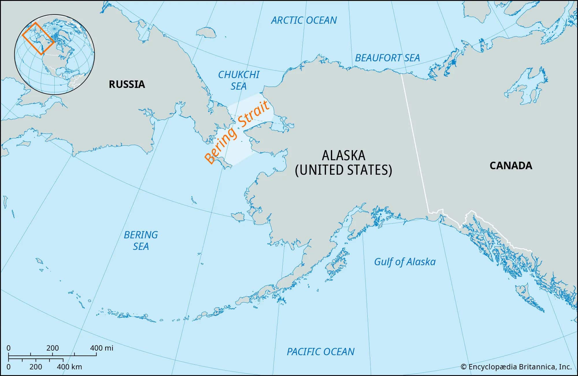
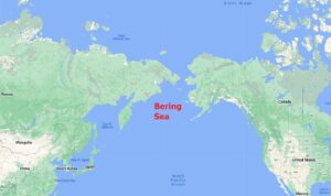
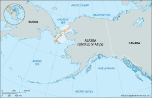
The Bering Sea lies between Alaska and the Russian Far East. The Aleutian Islands form its southern boundary with the North Pacific, while the Bering Strait connects its northern end to the Chukchi Sea and the Arctic Ocean. Although its Alaskan waters are among the United States’ most demanding operating environments, the sea itself extends beyond American waters.
Its seabed is far from uniform. A broad continental shelf occupies much of the eastern region, alongside a much deeper basin. NOAA describes the eastern shelf as more than 500 kilometres wide, adjoining a narrow continental slope and the extensive Aleutian Basin.
For a mariner, this geography creates different problems within the same voyage. Offshore exposure, island passages and coastal approaches require different assessments. A sheltered destination is useful only if the vessel can reach it safely, and an island that provides protection from one wind direction may offer much less when the storm moves.
Why Bering Sea storms become so powerful
The region sits beneath an active North Pacific storm track. Weather systems moving towards the Aleutians encounter strong contrasts between cold northern air and warmer maritime air farther south. These contrasts help support the development of powerful extratropical cyclones.
The Aleutian Low is central to this pattern. It describes a recurring low-pressure feature in the average atmospheric circulation, rather than one permanent storm sitting over the islands. NOAA’s physical oceanography review explains that it strengthens during winter, when storm activity and wind forcing become much more pronounced.
Within an individual cyclone, a steep pressure gradient can drive severe winds across a large area. The difficulty is therefore not confined to the storm’s centre. A vessel can encounter dangerous conditions well away from the lowest pressure.
Hurricane-force winds do not necessarily mean a tropical hurricane. The term describes wind strength. Bering Sea storms can reach that strength while having the structure of an extratropical cyclone.
| Marine warning term | Wind speed | Meaning for the reader |
|---|---|---|
| Gale force | 34–47 knots | Strong winds capable of producing hazardous seas |
| Storm force | 48–63 knots | More severe conditions with major operational implications |
| Hurricane force | 64 knots or more | Hurricane-strength winds, including within extratropical systems |
These are the wind bands used in the Ocean Prediction Center’s terminology. Wave conditions still depend on the storm’s duration, movement and the water over which the wind blows.
How the wind builds such enormous waves
Waves grow as wind transfers energy to the sea. Three factors are especially important: wind speed, the length of time it blows, and fetch, meaning the distance across water over which it acts.
The Bering Sea gives major storms room to build a substantial wave field. Strong winds continuing over a long fetch can generate much larger seas than a brief burst of equally strong wind over sheltered water. National Weather Service guidance identifies those three variables as fundamental controls on wind-wave growth. weather.gov
However, a forecast wave height is not the height of every wave.
Significant wave height is approximately the average height of the highest one-third of waves. Individual waves can be much larger; NWS guidance explains that the largest encountered may approach twice the significant height. A forecast of six-metre seas therefore does not establish a six-metre ceiling.
The spacing and direction of waves also matter. Short, steep seas can produce violent pitching, while separate wave systems arriving from different directions create an irregular motion that is difficult to anticipate. This is why detailed forecasts include period and direction alongside height. weather.gov
Read the whole sea state
“How high are the waves?” is only the first question. Their period, direction and relationship to the vessel determine how those waves are experienced aboard.
Watch the video and subscribe to our channel:
A measured example: the remnants of Typhoon Merbok
In September 2022, the remnants of Typhoon Merbok produced an exceptionally destructive Bering Sea storm. Its tropical origin is important, but its impact in Alaska involved a transformed storm system.
Researchers at the University of Maryland’s Earth System Science Interdisciplinary Center reported 17 satellite observations of significant wave height exceeding 14 metres, approximately 46 feet, during 16–17 September. These were measurements of significant wave height, not claims that every wave reached the same height.
Their analysis also found that the roughest Bering Sea conditions were most commonly observed from November through February, making Merbok’s extreme September seas particularly noteworthy. ESSIC
The consequences extended ashore. NOAA documented severe disruption to coastal and river communities, including damaged homes, roads and infrastructure, alongside interruptions to autumn hunting and harvesting. The event demonstrated that the same storm can threaten ships offshore and undermine the communities on which maritime activity depends. NOAA Arctic
Freezing spray: when the sea adds weight to the ship
One of the Bering Sea’s most serious hazards is less obvious than a breaking wave. Spray can strike exposed surfaces and freeze, building layers of ice on railings, deck equipment, fishing gear and the superstructure.
The consequences are structural and operational, but especially significant for stability. Ice accumulating high above the deck raises the vessel’s centre of gravity and can reduce its ability to recover from a heel. Uneven accumulation can make the situation worse.
The U.S. Coast Guard specifically warns operators to assess icing forecasts and ensure that stability instructions reflect the vessel’s actual loading and equipment. It also identifies avoiding icing, seeking shelter and appropriate changes of speed or heading among possible mitigation measures. The appropriate response depends on the vessel and circumstances.
Ice removal is demanding work on a moving deck. The operational aim should be to prevent an accumulating problem from outrunning the crew’s ability to control it.
Open water does not mean freedom from ice hazards. A vessel can encounter dangerous freezing spray without being surrounded by sea ice. Mariners therefore need both sea-ice information and freezing-spray guidance; they describe different threats.
What the loss of Destination teaches
On 11 February 2017, the fishing vessel Destination capsized and sank in the Bering Sea near St. George Island. All six crewmembers were lost.
The National Transportation Safety Board identified the probable cause as the decision to proceed in heavy freezing spray without ensuring an adequate stability margin for ice accumulation, or taking sufficient action to avoid or limit icing.
The lesson is specific: a vessel’s safety cannot be judged only from how it behaved before ice began to accumulate. Its loading condition changes as ice is added, and the margin available at departure may no longer exist later in the voyage. ntsb.gov
This is why stability information belongs in everyday operational decisions. It should inform what is carried, where weight is placed and when changing conditions require a different plan.
The human danger: cold water, fatigue and reduced visibility
Cold-water immersion can become life-threatening before hypothermia fully develops. The initial cold-shock response can cause involuntary gasping and rapid breathing, increasing the risk of inhaling water. Cooling also reduces muscular control and makes self-rescue more difficult.
There is no single reliable “survival time” for everyone. Clothing, flotation, protective equipment, sea state and the circumstances of immersion all influence the outcome. Suitable flotation and thermal protection are therefore essential parts of preparation. weather.gov
Aboard the vessel, continual movement makes ordinary jobs harder. Crossing a compartment, handling tools or getting adequate rest becomes more demanding. As a practical consequence, a task that looks routine in the work plan may need more time and support during heavy weather.
Visibility adds another burden. Fog, snow and spray can obscure other vessels and navigation marks. NWS guidance highlights the navigation hazards created by fog over water. Electronic information helps, but watchkeepers still need to understand its limits and maintain an effective lookout. weather.gov
What ships must protect when the weather deteriorates
From the bridge, the most visible problem may be a wall of water. Across the ship, the challenge is keeping several essential functions available together.
| Area | What can go wrong | Operational priority |
|---|---|---|
| Navigation | Reduced visibility and difficulty maintaining the intended track | Reassess the route, sea room and vessel response |
| Stability | Ice accumulation, shifted loads or water entering the vessel | Monitor changes and protect watertight integrity |
| Propulsion and power | Machinery faults or water damage reduce control | Maintain readiness and communicate limitations |
| Deck operations | Moving gear and boarding seas expose personnel | Secure equipment and restrict unnecessary exposure |
| Emergency response | Conditions complicate evacuation and rescue | Keep equipment accessible and responsibilities clear |
These priorities interact. A loss of electrical power can become a navigation problem; damaged closures can become a flooding problem; an injured crewmember can reduce the people available to manage both.
A wave can disable systems above the waterline
The fishing vessel Progress provides a documented example. On 26 January 2018, while riding out heavy weather north of Unimak Island, a large wave struck its wheelhouse.
The NTSB reported damaged windows, seawater damage to navigation and electrical equipment, and loss of electrical power. The five crewmembers regained control, and assisting vessels guided Progress back to Dutch Harbor. ntsb.gov
The incident illustrates why heavy-weather resilience includes windows, closures and the protection of critical equipment. Keeping the hull afloat is only one part of keeping the vessel operational.
Machinery readiness matters before the first heavy roll
For engineers, preparation should answer practical questions. Are known defects likely to restrict propulsion or electrical power? Is essential equipment accessible? Are loose tools and stores secured? Does the bridge understand any machinery limitations?
These questions are particularly valuable before conditions make inspection or repair difficult. A maintenance job that requires stable footing, lifting equipment or several people may become impractical once the vessel is moving heavily.
The bridge and engine room therefore need a shared understanding of what the ship can sustain. Decisions about speed and heading are stronger when they include actual machinery condition and the crew’s capacity to respond.
Heavy-weather decisions begin before departure
The best opportunity to reduce exposure often comes before sailing. Once the vessel is committed to a difficult passage, its options may narrow.
A useful planning sequence is:
- Review the developing weather. Consider the whole passage, including arrival conditions and alternative destinations.
- Confirm the loading condition. Check that the stability information represents the vessel, equipment and loads actually aboard.
- Prepare the ship. Verify closures, secure cargo and equipment, and address defects that could become critical.
- Agree decision points. Identify when changing forecasts or vessel behaviour should trigger a fresh assessment.
- Prepare the people. Clarify duties, communications and emergency arrangements before noise and motion make coordination harder.
This is an operational framework rather than a universal checklist. Each vessel needs its own approved procedures.
IMO’s guidance on adverse weather explains that vulnerability depends on factors including hull geometry, stability, size and speed. It also recognises that dangerous rolling or capsizing conditions can arise from particular combinations of waves and vessel response. 1228.doc
There is consequently no single heading or speed that is safest for every ship. A change that reduces one problem may increase another. Masters must consider the actual response, available sea room and the vessel’s specific guidance.
Make the decision while options remain
Delaying departure or changing a passage plan can preserve choices that disappear once weather, machinery limitations and proximity to land combine.
Why rescue can be so difficult
The Bering Sea has professional search-and-rescue coverage, but geography and weather place real limits on response.
An aircraft must reach the casualty, operate in the conditions and retain sufficient fuel. A rescue vessel must make its way through the same seas that caused the emergency. Finding a person or liferaft is a separate challenge from reaching the general area.
A Coast Guard account of cutter Munro’s 2025 patrol describes the ship refuelling a rescue helicopter at sea during a search near Nunivak Island, more than 300 nautical miles from Cold Bay. That example shows how rescue endurance may depend on several assets working together. news.uscg.mil
For those aboard a casualty, the practical implications are clear: emergency communications must work, survival equipment must be accessible, and drills must translate into actions people can perform under stress.
Rescue capability is vital, but a voyage plan should leave room for a delayed response.
Why people continue working in these waters
The sea’s danger exists alongside its economic and ecological importance. NOAA Fisheries describes the Bering Sea as supporting approximately 40% of the U.S. commercial fishery catch, while also documenting substantial ecosystem changes. NOAA Fisheries
That helps explain the presence of fishing vessels and the wider network of processing, transport and support activity. Maritime work also connects communities that depend on reliable deliveries.
It is useful to distinguish these activities. Catching fish, carrying cargo, supplying fuel and supporting remote settlements involve different vessel types and operating patterns. They should not be treated as one uniform trade route or exposed to one assumed level of risk.
Commercial pressure can make the decision to wait difficult. A delayed voyage may affect a fishing opportunity, a delivery or a crew change. Good planning must acknowledge those pressures while preserving the master’s ability to respond to deteriorating conditions.
The objective is to complete the work with a realistic understanding of what the vessel and crew can withstand.
Watching storm footage with a mariner’s eye
Real footage can help viewers understand the Bering Sea, but the camera rarely shows the whole situation. Lens perspective and camera movement can make wave-height estimates unreliable.
Instead of judging a clip only by its most spectacular crest, look for useful clues:
- Bow movement: Is the vessel rising smoothly, or striking heavily after each pitch?
- Water on deck: Is it light spray or a substantial volume of boarding water?
- Rolling: Does the motion remain controlled, or appear to increase?
- Ice: Are exposed surfaces and equipment becoming coated?
- Crew exposure: Are people required to work in areas repeatedly swept by water?
These are prompts for observation, not enough evidence to declare a vessel safe or unsafe. The viewer usually lacks the loading condition, forecast, machinery status and decisions being made on the bridge.
Verified footage becomes more informative when its location, date and vessel are known. A dramatic clip without that context cannot establish what Bering Sea conditions are normally like.
Frequently asked questions
Is the Bering Sea always rough?
No. Conditions vary across its large area and through the seasons. Its reputation reflects the severity of the conditions that can develop, rather than uninterrupted storm weather. A calm period does not remove the need to assess the next weather system.
When are the worst storms most likely?
The colder months are generally more demanding. The satellite analysis discussed above identified November through February as the period when the roughest seas were most commonly observed. Merbok demonstrates that exceptionally severe conditions can also occur outside that period. ESSIC
Can large ships cross safely?
Yes, but size alone does not establish safety. Loading, stability, structural condition, machinery reliability, routing and ship handling all matter. A large vessel can still encounter dangerous motions or damage in an unfavourable sea state.
Are freezing spray and sea ice the same thing?
No. Sea ice is frozen seawater in the marine environment. Freezing spray builds ice on the vessel after airborne spray strikes exposed surfaces. A ship may face the second hazard while sailing through open water.
Is it the world’s most dangerous sea?
There is no single authoritative ranking that settles that question. Risk depends on the vessel, activity, season and measure being used. The Bering Sea’s combination of severe weather, icing, cold-water exposure and remoteness is enough to explain its formidable reputation.
Respecting the sea means understanding the limits
The Bering Sea’s power is visible in its breaking waves, but safe operation depends on less dramatic details: an accurate loading assessment, a sound closure, dependable machinery, a rested watchkeeper and a decision made early enough to matter.
The crews who work here need more than toughness. They need reliable information, maintained vessels and the freedom to change plans when conditions demand it.
Behind every memorable storm image is the same practical question: how much margin remains if the next problem arrives now?