

Ship Navigation Charts
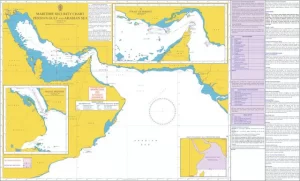
Navigational charts used on commercial ships come in two primary formats: paper charts and electronic charts. Paper charts are traditional printed maps that are still widely used on ships today. Electronic charts, also known as Electronic Chart Display and Information System (ECDIS), are computer-based systems that provide digital charts and additional information to the navigator.
Here are some of the key features and considerations of navigational charts on commercial ships:
- Accuracy: The accuracy of navigational charts is critical for safe navigation. The charts must be up-to-date and accurate to ensure that the ship is navigating in safe waters.
- Chart symbols and legends: Navigational charts use symbols and legends to convey information about the water depth, navigational hazards, and other features of the sea. The crew must be trained to interpret these symbols and legends correctly.
- Scale: The scale of the chart indicates the level of detail shown on the map. A smaller scale chart shows a larger area but less detail, while a larger scale chart shows a smaller area but more detail. The scale used depends on the ship’s size, speed, and route.
- Chart corrections: Navigational charts are frequently updated to reflect changes in water depth, navigational hazards, and other features of the sea. The crew must ensure that the charts are up-to-date and apply chart corrections regularly.
- Chart storage: Paper charts must be stored correctly to prevent damage from moisture, humidity, and sunlight. Electronic charts are stored on a computer or other device and must be backed up regularly to prevent data loss.
- Compatibility: Electronic charts must be compatible with the ship’s navigation system and other electronic devices on the ship. The crew must ensure that the charts are compatible and updated regularly.
- Redundancy: It is essential to have redundant navigation systems on the ship to ensure safe navigation in case of system failure. This includes having multiple navigational charts and backup navigation systems such as a magnetic compass.
Navigational charts are a critical tool for safe and efficient navigation on commercial ships. The crew must be trained to use them effectively and ensure that the charts are up-to-date and accurate. Regular maintenance and backups of electronic charts are necessary to prevent data loss and ensure compatibility with the ship’s navigation system.
–
Electronic Chart Display and Information System (ECDIS)

Electronic Chart Display and Information System (ECDIS) is a computer-based navigation system used on the navigational bridge of commercial ships. It provides digital charts and additional information to the navigator, allowing for safe and efficient navigation.
ECDIS replaces traditional paper charts with electronic charts, which are stored on a computer or other electronic device. The system provides real-time information on the ship’s position, speed, and heading, as well as the surrounding environment such as other vessels, coastlines, and navigational hazards. ECDIS is an essential tool for modern navigation on commercial ships and is required on most vessels by international regulations.
Here are some of the key features and benefits of ECDIS on the navigational bridge of commercial ships:
- Accuracy: ECDIS provides accurate and up-to-date information on the ship’s position, speed, and heading, as well as the surrounding environment. The system uses data from a variety of sources, including GPS, radar, and other navigational sensors, to ensure accuracy.
- Efficiency: ECDIS allows for efficient navigation, as it provides a comprehensive view of the ship’s surroundings, allowing for quicker and more informed decision-making. The system also allows for automatic route planning, reducing the time and effort required for manual navigation.
- Safety: ECDIS improves safety by providing real-time information on the ship’s position, speed, and heading, as well as the surrounding environment. It also alerts the navigator to potential hazards such as shallow water, navigational hazards, and other vessels in the area.
- Integration: ECDIS can be integrated with other navigation systems such as radar and automatic identification systems (AIS), providing a more comprehensive view of the ship’s surroundings.
- Training: The crew must be trained to use ECDIS effectively. The system requires a higher level of technical knowledge and expertise than traditional paper charts, and crew members must be proficient in its use and interpretation of the information displayed on the screen.
- Maintenance: ECDIS requires regular maintenance and updates to ensure that it is functioning correctly and providing accurate information. This includes updating the electronic charts, software, and hardware, as well as testing the system regularly.
- Redundancy: It is essential to have redundant navigation systems on the ship to ensure safe navigation in case of system failure. This includes having backup electronic charts and backup navigation systems such as a magnetic compass.
ECDIS is a critical tool for safe and efficient navigation on commercial ships. It provides accurate and up-to-date information on the ship’s position, speed, and heading, as well as the surrounding environment, allowing for quicker and more informed decision-making. The crew must be trained to use ECDIS effectively, and the system requires regular maintenance and updates to ensure that it is functioning correctly and providing accurate information.
While Electronic Chart Display and Information System (ECDIS) is a powerful tool that enhances safety and efficiency on the navigational bridge of commercial ships, it is not without safety and security risks. Here are some of the potential safety and security risks associated with using ECDIS onboard ships:
- Over-reliance: One of the main safety risks associated with ECDIS is over-reliance on the system. The navigator may become too dependent on the system and not pay enough attention to other navigational aids, such as radar or visual observations.
- Incorrect data entry: ECDIS relies on accurate data entry to provide reliable information. However, incorrect data entry or errors in the electronic charts can lead to incorrect information being displayed on the screen, potentially leading to a navigational error.
- System failure: ECDIS is a computer-based system, and like all electronic systems, it is vulnerable to system failure. A malfunction or failure of the system can lead to loss of critical navigational information, potentially resulting in a navigational error.
- Cybersecurity: ECDIS systems are connected to the ship’s network, which can make them vulnerable to cyber attacks. A hacker could potentially gain access to the system and manipulate the information displayed on the screen, leading to a navigational error or other safety risks.
- Lack of standardization: ECDIS systems are not standardized across all ships, which can lead to confusion and potential safety risks. Different ECDIS systems may have different features, display information differently, or use different electronic charts, making it challenging for the navigator to switch between systems.
To mitigate these safety and security risks, it is essential to provide proper training to the crew on the use of ECDIS and to ensure that they understand its limitations and potential risks. Regular testing and maintenance of the system are also necessary to ensure that it is functioning correctly and providing accurate information. Backup navigation systems, such as paper charts and magnetic compasses, should also be available in case of ECDIS system failure. Finally, cybersecurity measures should be implemented to protect the ECDIS system from potential cyber attacks.
By MaritimEducation team.
2 thoughts on “Navigation Charts and ECDIS on Ships”