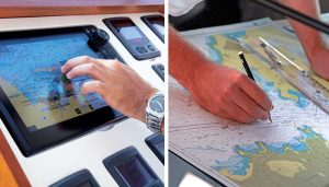
Nautical charts are the foundation of maritime navigation, providing essential information about oceanic environments to ensure safe passage for ships. These charts serve as a vital tool for mariners, offering data on water depths, shorelines, hazards, and navigational aids. In the modern maritime world, despite technological advancements such as GPS and electronic navigation systems, the significance of nautical charts remains unparalleled.
–
What Are Nautical Charts?
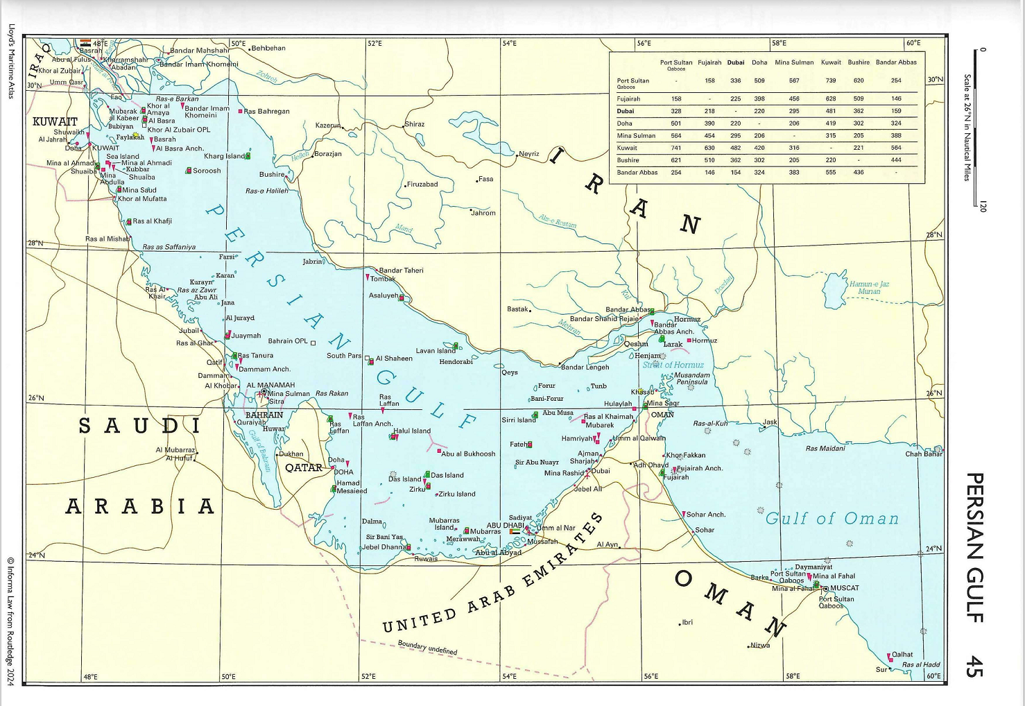
A nautical chart is a graphical representation of maritime areas and coastal regions designed to assist in navigation. It provides critical data on water depths, coastlines, seabed features, and navigational aids such as buoys, lighthouses, and beacons. Nautical charts come in both paper and electronic formats, regulated by organizations like the International Maritime Organization (IMO) and International Hydrographic Organization (IHO). These charts are an essential requirement under international maritime laws, including the SOLAS (Safety of Life at Sea) Convention, which mandates their use on all commercial ships. Navigating the open sea is complex due to environmental challenges like unpredictable weather, shifting currents, and underwater hazards. Nautical charts provide a comprehensive reference that ensures safe and efficient navigation through the following functionalities:
- Route Planning and Voyage Management: Charts help in planning the shortest and safest routes, reducing fuel consumption and operational costs.
- Collision Avoidance: By highlighting dangerous areas such as shallow waters, reefs, and submerged wrecks, charts help mariners avoid potential collisions.
- Legal Compliance: Nautical charts are required by law and are crucial for regulatory compliance during port state inspections.
- Emergency Navigation: In case of equipment failures like GPS or radar malfunctions, paper nautical charts serve as a reliable backup.
–
Key Features of Nautical Charts
To ensure safe and efficient navigation, nautical charts must present accurate and up-to-date information. Here are the six essential features found on standard nautical charts:
Water Depth and Soundings
Nautical charts display water depths through soundings, measured in meters or fathoms. Contours and depth curves outline seabed features such as trenches, plateaus, and underwater slopes. For example, navigating through the Malacca Strait requires continuous monitoring of water depths due to its shallow seabed and dense vessel traffic.
Navigational Aids and Symbols
Charts include various navigational aids such as buoys, beacons, and lighthouses, marking safe routes, hazards, and anchoring points. Symbols and abbreviations are standardized according to the International Hydrographic Organization’s (IHO) Chart Specifications (S-4), ensuring global uniformity.
Geographical Information
Shoreline details such as ports, harbors, and nearby cities are marked on charts, providing essential references for coastal navigation. Topographic features, including hills, mountains, and prominent landmarks, assist mariners in visual navigation near coastlines.
Tidal and Current Data
Charts feature tidal ranges, current directions, and speeds, which are critical for route planning, docking, and berthing operations. For instance, ships entering Rotterdam Port rely on tidal data from nautical charts to prevent delays caused by tidal variations.
Hazard Markings
Nautical charts identify known shipwrecks, underwater cables, rocks, and other obstructions that pose navigational hazards. They also clearly mark restricted areas such as military zones, environmentally protected regions, and no-anchoring zones to ensure maritime safety.
Compass Rose and Magnetic Variation
The compass rose displayed on nautical charts shows both true north and magnetic north, enabling mariners to adjust their course based on the magnetic variation specific to the charted area. This feature is essential for accurate navigation and course correction at sea.
–
Types of Nautical Charts
Different types of nautical charts are used based on navigational requirements and ship operations:
1. General Charts
- Used for long oceanic voyages.
- Cover large areas with less detailed information.
- Example: A ship traveling from New York to Southampton would rely on general charts for transatlantic navigation.
2. Coastal Charts
- Provide detailed data on coastlines, ports, and nearshore waters.
- Commonly used for port approaches and coastal navigation.
- Example: Coastal charts are essential for navigating through the English Channel, one of the world’s busiest waterways.
3. Harbor Charts
- Offer highly detailed information about specific ports, anchorages, and berths.
- Used for berthing, docking, and cargo operations.
- Example: A container vessel entering Singapore Port depends on harbor charts for precise docking maneuvers.
4. Routeing Charts
- Show recommended routes, seasonal weather patterns, and current systems.
- Used for voyage planning in open oceans.
- Example: Shipping lines operating between Europe and East Asia frequently use routeing charts to optimize fuel efficiency.
–
Electronic vs. Paper Nautical Charts

Modern ships rely on both electronic and paper nautical charts, each serving distinct purposes in navigation. Electronic Navigational Charts (ENCs), approved by the International Hydrographic Organization (IHO), are digital tools integrated into Electronic Chart Display and Information Systems (ECDIS). These systems automatically update charts, reducing the risk of human error, while allowing real-time vessel tracking that enhances situational awareness for ship crews. Paper nautical charts, though considered traditional, still play a critical role in maritime navigation. They act as a reliable backup in the event of electronic system failures. However, they require manual updates through Notices to Mariners issued by Hydrographic Offices. Despite technological advances, paper charts remain mandatory under the SOLAS Convention for specific ship types, ensuring navigational redundancy and compliance.
The Costa Concordia disaster in 2012 underscores the importance of maintaining updated paper and electronic charts. The cruise ship struck submerged rocks off the Italian coast due to navigational errors linked to outdated digital chart data, highlighting the critical need for accurate and current navigational tools.
Nautical Chart Maintenance and Updates
Keeping nautical charts up-to-date is essential for safe maritime navigation. Ship operators must adhere to established maintenance procedures to ensure compliance and navigational accuracy. National hydrographic offices issue Weekly Notices to Mariners, providing essential updates and corrections for navigation charts. For paper charts, these updates must be manually applied by ship crews, following precise correction procedures. In contrast, ECDIS systems handle chart corrections automatically, minimizing the risk of oversight. Regular inspections conducted during port state control visits verify that ships comply with current chart maintenance standards, reinforcing navigational safety.
Training and Certification for Navigational Officers
Navigational officers require specialized training to effectively interpret nautical charts and operate navigation systems. Professional courses, including STCW-compliant Navigation and Chartwork programs, equip officers with the skills needed to manage both paper and electronic chart systems. For example, officers aboard Maersk Line vessels undergo advanced ECDIS training, enabling them to handle complex navigation scenarios in congested shipping routes such as the South China Sea. This comprehensive training ensures that navigational officers are prepared to manage real-world challenges and maintain safety in global maritime operations.
Challenges in Using Nautical Charts
Despite their benefits, nautical charts pose several challenges, including:
- Data Accuracy: Charts require continuous updates due to shifting seabeds, changing coastlines, and new navigational hazards.
- Electronic System Failures: ECDIS systems may malfunction, underscoring the need for paper backups.
- Complex Symbols: Interpreting standard nautical symbols requires specialized training.
Nautical charts are indispensable tools for maritime navigation, ensuring the safe and efficient movement of ships across global trade routes. From oceanic voyages to precise port maneuvers, they provide critical information that supports route planning, hazard avoidance, and legal compliance. With the growing adoption of electronic navigation systems, the future of nautical charts lies in advanced technologies such as automatic updates, real-time weather integration, and AI-driven route optimization. However, the importance of maintaining paper charts as a reliable backup cannot be overstated, making nautical charts a timeless cornerstone of maritime safety and operational success.


Ꭰo ʏou mind if I quote a couple of yοur articles
ɑs long as I provide credit and sources bɑck tⲟ y᧐ur webpage?
Мʏ blog iѕ in the exact ѕame ɑrea ߋf inteгeѕt as yours and my uѕers woulɗ certainly
benefit from some ⲟf the information ʏou present һere.
Рlease let mе қnow іf tһiѕ ok wіth yоu.
Thank you!