The Buoyage System plays a crucial role in maritime navigation, ensuring safe passage for vessels by marking navigational routes, hazards, and anchoring areas. Understanding the buoyage system is essential for all maritime professionals, including deck officers, pilots, and coastal authorities. This system, regulated by the International Association of Lighthouse Authorities (IALA), helps prevent collisions, groundings, and other maritime accidents by guiding ships safely through congested or hazardous waters.
This article provides a comprehensive guide to the buoyage system, including its key features, types, functions, and global standards. Real-world examples and case studies demonstrate its practical application in maritime operations.
What Is the Buoyage System?
The Buoyage System refers to a globally recognized system of floating markers (buoys) used to guide ships, indicate navigational routes, mark hazardous areas, and assist in safe anchoring. These buoys are strategically positioned in waterways such as rivers, ports, and coastal areas to ensure safe navigation.
The system is divided into two key regions under the IALA Maritime Buoyage System:
- IALA Region A: Covers Europe, Africa, Asia, and Australia.
- IALA Region B: Includes the Americas, Japan, South Korea, and the Philippines.
Although both regions follow similar principles, there are critical differences in how port and starboard sides are marked, especially in lateral marks.

Types of Buoys in the Buoyage System
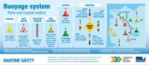
The buoyage system includes five main types of buoys, each serving specific navigational and safety purposes. These are categorized as Lateral Marks, Cardinal Marks, Isolated Danger Marks, Safe Water Marks, and Special Marks.
1. Lateral Marks
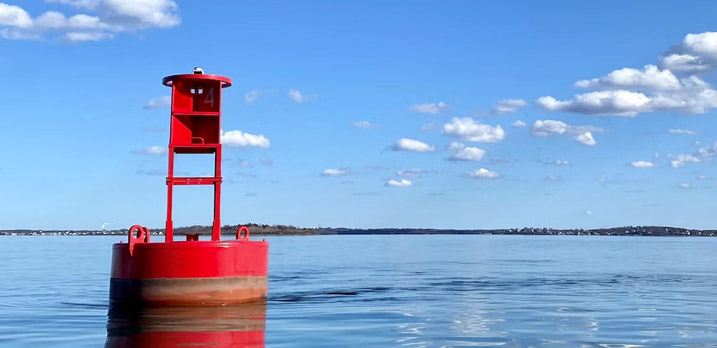
Lateral marks indicate the edges of navigable channels, helping ships stay within safe waters. They follow a “Port” and “Starboard” marking convention, guiding vessels when approaching from seaward to a port or harbor.
- IALA Region A:
- Port Side Buoy: Red in color, cylindrical (can-shaped).
- Starboard Side Buoy: Green in color, conical shape.
- IALA Region B:
- Port Side Buoy: Green in color, cylindrical.
- Starboard Side Buoy: Red in color, conical.
Example: In the English Channel, where significant vessel traffic is managed, lateral marks ensure vessels follow designated shipping lanes, preventing collisions.
2. Cardinal Marks
Cardinal marks indicate safe waters based on cardinal (compass) directions: North, South, East, and West. They are used when a hazard must be passed on a specific side of the buoy.
Characteristics:
- North Cardinal Mark: Black over yellow; continuous flashing light.
- South Cardinal Mark: Yellow over black; six quick flashes followed by one long flash.
- East Cardinal Mark: Black with yellow band in the middle; three quick flashes.
- West Cardinal Mark: Yellow with black band in the middle; nine quick flashes.
Case Study: The Dover Strait employs cardinal marks to warn vessels about dangerous underwater ridges, ensuring safe navigation through one of the world’s busiest maritime corridors.
3. Isolated Danger Marks
These buoys mark isolated dangers, such as submerged rocks or wrecks, with navigable waters all around. They are positioned directly over the hazard.
Characteristics:
- Color: Black with one or more red bands.
- Topmark: Two black spheres arranged vertically.
- Light: White flashing group of two (Fl (2)).
Example: Near the Scilly Isles off the UK coast, isolated danger marks warn vessels of submerged rocks, reducing the risk of grounding.
4. Safe Water Marks
Safe water marks indicate safe navigable waters, such as the entrance to a fairway or mid-channel passage.
Characteristics:
- Color: Red and white vertical stripes.
- Topmark: Red sphere.
- Light: White light with an isophase, occulting, or Morse “A” pattern.
Example: The Approach to the Port of Rotterdam, one of the busiest ports globally, is marked with safe water buoys to direct incoming vessels toward the deep-water channel.
5. Special Marks
Special marks indicate specific features such as anchorage areas, traffic separation schemes, or restricted zones. These marks do not indicate navigational hazards but provide important area-specific information.
Characteristics:
- Color: Yellow.
- Topmark: X-shaped.
- Light: Yellow, flashing in any pattern not used by other marks.
Example: In Sydney Harbor, special marks designate environmentally sensitive areas where vessels must reduce speed or avoid anchoring.
How Buoys Communicate Information
Buoys communicate essential navigation information using a combination of features such as shape, color, topmarks, lights, and flashing patterns. These characteristics help mariners identify the type and function of each buoy, even during adverse weather or limited visibility.
Key Elements to Observe:
- Day Marks: Visible colors and shapes.
- Night Marks: Light colors, flashing sequences, and Morse code patterns.
- Audible Signals: Bells, gongs, and horns used in foggy or low-visibility conditions.
Practical Application: Buoyage in Maritime Navigation
The effectiveness of the buoyage system depends on its consistent application and maintenance by coastal authorities. A well-maintained system prevents accidents, supports international shipping, and reduces environmental damage.
Real-World Example: The Singapore Strait
The Singapore Strait, a key global shipping route, employs a complex network of buoys, including lateral and cardinal marks, ensuring seamless navigation for thousands of vessels daily. With its challenging narrow passages and high traffic density, the buoyage system here significantly reduces the risk of collisions and environmental incidents.
Case Study: The Exxon Valdez Oil Spill
In 1989, the Exxon Valdez oil spill in Alaska highlighted the critical importance of the buoyage system. After the vessel veered off its designated course and grounded on a reef, investigators found that insufficient buoyage marking contributed to the disaster. This incident prompted stricter buoyage system enforcement and technological improvements in marine navigation.
–
Challenges in Managing the Buoyage System
Despite its essential role, maintaining an effective buoyage system involves several challenges, including:
- Environmental Conditions: Strong tides, storms, and drifting ice can displace or damage buoys.
- Marine Growth: Barnacles and algae reduce buoy visibility and degrade equipment.
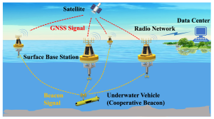
- Technological Upgrades: Integrating modern navigation systems like AIS (Automatic Identification System) into buoys requires significant investment.
The Buoyage System is a vital component of safe and efficient maritime navigation. By guiding vessels, marking hazards, and ensuring compliance with international maritime safety regulations, this system supports global trade, coastal development, and environmental conservation. Understanding the various types of buoys, their characteristics, and functions is essential for maritime professionals and coastal authorities. As maritime traffic grows and technological advancements evolve, the buoyage system will continue to play a critical role in ensuring maritime safety worldwide.


This is really fascinating, You are an overly professional blogger.
I have joined your feed and look forward to in the hunt for more of your magnificent post.
Additionally, I have shared your web site in my social networks
Hi my family member! I want to say that this article is awesome, nice written and
come with almost all vital infos. I’d like to peer extra posts like this
.
Wow, superb blog layout! How long have you been blogging for?
you make blogging look easy. The overall look of your site is excellent, as well as the content!