

Discover the hidden depths of the Mozambique Channel—from its powerful currents and strategic maritime role to rich biodiversity and security challenges. This comprehensive guide unveils 7 surprising facts that every maritime professional, enthusiast, and student should know.
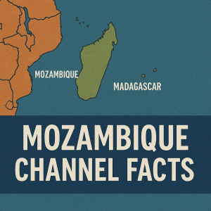
The Mozambique Channel, an arm of the Indian Ocean nestled between Mozambique and Madagascar, is so much more than a marine corridor—it’s a dynamic blend of geology, biodiversity, culture, and geopolitics. Whether you’re a maritime professional, student, or ocean lover, understanding seven lesser-known dimensions of this channel can reshape how you view regional shipping, environmental conservation, and strategic security.
Why the Mozambique Channel Matters in Modern Maritime Operations
Stretching approximately 1,600 km in length and spanning 400–950 km in width, the channel reaches depths over 3,200 m—deeper than Mont Blanc is tall . It serves as:
-
A major shipping passage connecting the Indian Ocean to southern Africa and the Agulhas Current system.
-
A lifeline for fisheries and coastal economies, especially for Madagascar, Comoros, and Mozambique.
-
A strategic hotspot, with growing security concerns—from piracy and trafficking to insurgency spillover.
-
A biodiversity treasure with rich marine habitats and unique species.
Let’s dive into the seven facts that define why this channel is so vital—and so fascinating.
1. Fluid Dynamics and the Mozambique Eddy Factory
The Mozambique Channel is famous for its anticyclonic eddies, not just a strong boundary current. These looping spinning currents, each up to 300 km across, churn southward 4–7 times a year .
-
Historical navigation maps criticized the Channel’s currents, especially around Cape Correntes (the “Cape of Currents”), as treacherous .
-
Modern hydrographic surveys show slow, shifting circulations creating a rolling “eddy factory” that feeds the powerful Agulhas Current .
Why it matters:
-
Mariners must optimize routing to ride or avoid eddy effects.
-
These eddies influence vertical mixing and marine ecosystems—shaping where fish feed, coral thrives, and heat moves.
2. A Megadiverse Marine Ecosystem
The channel is a globally recognized marine biodiversity hotspot.Notable features include:
-
Coral reefs with 250–300 recorded species, potentially reaching 450 species .
-
A rich population of marine mammals: 22 species including baleen and toothed whales, dolphins, and dugongs .
-
Biological corridors known to guide frigatebirds and tuna between oceanic fronts .
Impact:
The channel supports artisanal fishing, tourism, and conservation efforts. Yet, it also faces illegal trawling, pollution from tanker spills, and climate impacts, making ecosystem knowledge essential to stakeholders and regulators from IMO, IUCN, and UNESCO.
3. Strategic Importance: Security Under Watch
Southern Africa’s maritime apparatus is still developing, rendering the Mozambique Channel vulnerable. In recent years, militant groups in northern Mozambique, piracy, and trafficking have caused global concern .
-
The Quad nations (India, Australia, Japan, US) and European powers are monitoring escalating risks to maritime trade .
-
Ships traversing the Channel must now navigate new security protocols, including private escort, rerouting, or convoy coordination.
Maritime relevance:
A sudden incident—like a spill or attack—could impact ports such as Maputo or Beira, affect global energy markets, and necessitate swift action from IMO and regional navies.
4. Natural Resources: Fisheries and Gas Reserves
Beyond transit, the Channel underpins economies and human livelihoods:
-
Fisheries: Artisanal catches (e.g., tuna, shrimp) could outpace official tallies—domestic harvesting may be 80% higher than reported .
-
For Madagascar, fisheries contribute ~7% to GDP; for Comoros, ~8%; for Seychelles, ~9% .
-
-
Energy: Six major natural gas concessions in the Rovuma Basin (since 2010) attract global operators like Eni and Anadarko .
Why it’s critical:
International investment depends on clear regulation. Regional bodies like IMO, IOCs, and P&I clubs must work together to balance resource development and environmental safeguards.
5. Environmental Hazards: Cyclones and Oil Risks
The channel’s climate and maritime activity combine to pose serious environmental threats:
-
It’s a breeding ground for strong cyclones, which bring high seas and coastal inundations .
-
The sinking of the Katina P in 1992 released 13,000 tonnes of heavy fuel, dispersed by the Agulhas Current, contaminating Maputo Bay, mangroves, and beaches .
Takeaways:
-
Shipping companies must enhance contingency planning and ensure oil spill compensation (TOVALOP schemes).
-
Port authorities and Coast Guards must align with IMO, Paris MoU, P&I, and local regs for disaster response.
6. Key Navigation Hazards and Historic Incidents
Several features and historical events warrant attention:
-
Cape Correntes, with swift currents and shoals, historically accounted for 30% of Portuguese India Armada losses .
-
Numerous reefs and atolls like Banc du Geyser and Bassas da India are maritime hazards.
-
WWII naval warfare included the “Graf Spee” incident and the Battle of Madagascar in 1942 .
Relevance to shipping:
Round-the-clock charting, AIS, ENC updates, and coastal route planning by IMO and classification societies are vital to safe navigation here.
7. Climate Change, Rising Sea-Level, and Adaptation
Climate trends pose long-term challenges:
-
Rising sea levels threaten coral reefs and coastlines.
-
Eddies may reshape currents, influencing regional fisheries, sedimentation, and coastal dynamics.
-
Tropical cyclone frequency appears to be increasing—requiring updated METAR, climate models, EMAP support.
Response strategies:
Maritime planners should integrate climate projections with adaptive regulations. Organizations like EMSA, UN, and S&P Global help quantify and track these shifts.
Case Studies and Real-World Applications
Katina P Oil Spill (1992): Lessons in Pollution Response 🌊
The sinking Greek tanker spilled heavy fuel into sensitive ecosystems. Poor planning and coastal vulnerability led to only $4.5M compensation—less than half the claim .
-
Key lessons: Early cleanup, stronger coastal legal frameworks, and P&I readiness.
Coastal Security Response: Evolving Threats
Following piracy and insurgency-linked incidents, regional governments, navies, and private companies adjusted maritime security:
-
Enhanced patrols and escort services.
-
Development of Area Maritime Security Plans.
-
IMO guidance aligned with port and marine authorities.
Fisheries Monitoring with Eddies
Satellite studies show marine predators—frigatebirds, tuna—follow eddies. Vessel and drone tracking can locate hotspots, helping regulators monitor fishing activity (with better sustainability) .
Frequently Asked Questions (FAQ)
Q1: How deep is the Mozambique Channel?
On average ~2,700 m; maximum depth reaches ~3,292 m (10,800 ft) about 230 km off Mozambique .
Q2: What causes the eddies in the channel?
Dominant anticyclonic gyres form due to interactions between currents, coastline, and wind, producing 4–7 eddies per year that shape water movement into the Agulhas Current .
Q3: Which species are unique to the region?
High coral diversity (250–450 species), 22 marine mammal species, including regionally isolated Omura’s whales and dugongs.
Q4: Is piracy common here?
More so near northern Mozambique and Comoros. The channel is also prone to trafficking and security threats from the land-based insurgency .
Q5: What significant maritime incidents have occurred?
Notable ones include WWII ship skirmishes (Graf Spee, Battle of Madagascar), the Katina P oil spill, and piracy-linked events .
Q6: Can climate change affect routes?
Absolutely—rising seas and changing currents could affect fisheries, navigation, and cyclone patterns, necessitating long-term adaptation.
Q7: Are there natural gas reserves here?
Yes—the Rovuma Basin has gas fields since 2010. Exploration is linked to environmental zones and biodiversity corridors .
Conclusion and Call to Action
The Mozambique Channel isn’t just a strip of water—it’s an evolving maritime frontier blending marine science, geopolitics, economy, and security. From eddy-driven dynamics to rich biodiversity, shifting currents, and regional geopolitics, each element impacts how maritime industries, regulators, and coastal communities operate and adapt.
For maritime professionals and enthusiasts, staying informed about navigational risks, legal frameworks, environmental benchmarks, and security dynamics isn’t optional—it’s essential. Whether you’re plotting shipping lanes, advising on oil spill response, conservation policy, or regional security, a nuanced understanding of this unique ocean corridor can shape more resilient and forward-thinking decisions.
What now? Dive deeper:
-
Follow IMO hydrographic and marine environment guidance.
-
Monitor eddy and climate models via S&P Global and oceanographic partners.
-
Partner with coastal nations to build stronger pollution response, security, and fisheries strategies.
References
-
Britannica. Mozambique Channel, Map, Africa, Location, Depth, & Facts.
-
Softschools. Mozambique Channel Facts.
-
ScienceDirect. Circulation of the Mozambique Channel. ScienceDirect
-
IISS / Lowy Institute. Security Challenges in Mozambique Channel. The Australian National University
-
Agulhas System Research. Observations of the flow in the Mozambique Channel. AGU Publications
-
Marine Mammal Habitat. Northwest Madagascar and Northeast Mozambique Channel IMMA.
-
Wikipedia. Katina P tanker spill.
-
Wikipedia. Cape Correntes.
-
Wikipedia. Mozambique Current.
-
Wikipedia. Mozambique Channel page.
-
Marine Insight. 10 Mozambique Channel Facts.
-
Marine Insight factoid content on diversity.