

In the world of maritime education, Nautical Science and Navigation form the bedrock of a ship officer’s training. Navigating a vessel safely and efficiently across vast oceans and congested coastal areas is a task of immense responsibility, requiring a deep understanding of both traditional and modern navigation techniques. At maritime academies and universities, future navigation officers of merchant ships undergo rigorous training in these disciplines to ensure they are equipped with the skills and knowledge necessary for safe passage.
This article delves into the core areas of nautical science and navigation, highlighting the principles, tools, and methodologies essential to the role of a merchant ship officer.
Principles of Coastal and Ocean Navigation
Coastal and ocean navigation are the two primary forms of navigation that a ship officer must master. Each presents its own set of challenges and requires specific methods and tools.
- Coastal Navigation
Coastal navigation occurs in waters where land is visible, typically within 20 to 30 nautical miles of the coast. Navigators rely on visual landmarks, nautical charts, and radar to determine the ship’s position. Coastal waters are often busier and shallower, making this form of navigation more dynamic and demanding. Officers must be adept at avoiding collisions, negotiating traffic separation schemes, and steering clear of hazards such as reefs, shoals, and sandbanks. - Ocean Navigation
Ocean navigation, on the other hand, takes place in open waters, often far from land. This type of navigation depends more on advanced instruments and celestial bodies for position fixing. Ship officers must use dead reckoning, celestial navigation, and electronic tools like GPS to maintain their course. Ocean voyages require careful voyage planning, accounting for factors like weather patterns, currents, and optimal routes to ensure fuel efficiency and safety.
Celestial Navigation: A Timeless Skill
While modern technology has revolutionized navigation, celestial navigation remains a critical skill for ship officers, serving as a backup in case electronic systems fail. Celestial navigation involves using the sun, moon, stars, and planets to determine the ship’s position. Navigators use a sextant to measure the angle between a celestial body and the horizon, and then reference nautical almanacs and sight reduction tables to calculate their latitude and longitude. Though it may seem old-fashioned in today’s GPS-dominated world, celestial navigation is still taught extensively at maritime academies. It provides a deep understanding of the Earth’s movement and position in relation to celestial bodies, allowing navigators to gain confidence in their ability to determine their position without relying on technology.
Navigational Instruments: Traditional and Modern Tools
The use of navigational instruments is central to a ship officer’s duties. Officers are trained to use both traditional and cutting-edge technology to ensure safe navigation.
- Sextants
One of the most iconic instruments, the sextant is used in celestial navigation to measure the angle between a celestial body and the horizon. Although it has been largely superseded by electronic systems, it remains a vital tool for emergency navigation. - Global Positioning System (GPS)
GPS is now the primary tool for determining a ship’s position. It provides highly accurate data on the ship’s latitude, longitude, and speed. Officers are trained to use GPS in conjunction with other systems to enhance navigation accuracy. - Radar
Radar is crucial for both collision avoidance and navigation in low visibility conditions such as fog or nighttime operations. It detects other vessels, landmasses, and potential hazards by emitting radio waves and interpreting their reflections. Radar is especially useful in coastal waters or when navigating near congested ports. - Electronic Chart Display and Information System (ECDIS)
ECDIS is a sophisticated system that integrates GPS data with electronic charts to provide real-time navigation information. It has largely replaced traditional paper charts on many ships, offering greater accuracy and ease of use. ECDIS systems also feature alarms that warn officers when the ship approaches hazards or deviates from its planned route. - Compasses
Magnetic and gyro compasses are still fundamental tools for navigation. A magnetic compass relies on the Earth’s magnetic field to indicate direction, while a gyro compass uses a spinning rotor and the Earth’s rotation to provide true north readings. Officers must be proficient in both types of compasses to navigate effectively.
Voyage Planning and Chartwork
One of the most critical responsibilities of a navigation officer is voyage planning. Before setting sail, officers must chart the vessel’s course, taking into account factors such as weather forecasts, tides, currents, traffic separation schemes, and any navigational hazards along the route. They must also consider the ship’s cargo, draft, and fuel efficiency when selecting the most appropriate route.
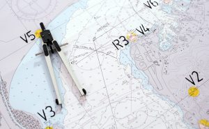
- Chartwork
Chartwork involves the use of nautical charts to plot a course and fix the ship’s position at regular intervals. Officers are trained in the use of both paper and electronic charts, ensuring they can navigate accurately regardless of the tools available. - Passage Planning
Passage planning is a detailed process that involves plotting every leg of the voyage, identifying potential hazards, and ensuring the ship complies with all relevant regulations. This plan includes a primary route as well as contingency routes in case of emergencies or changing weather conditions. The plan must also be updated throughout the voyage as conditions change.
The Integration of Traditional and Modern Navigation Methods
While modern electronic systems like GPS and ECDIS have made navigation more efficient and accurate, traditional methods like celestial navigation, chartwork, and compass use remain integral parts of a ship officer’s training. These methods serve as essential backups in the event of electronic failures, which, although rare, can happen due to system malfunctions or external factors like cyber-attacks.
Maritime academies and universities strike a careful balance between teaching cutting-edge technology and preserving traditional navigational techniques. This ensures that ship officers are equipped with a broad set of skills, enabling them to handle any navigational challenge they may encounter at sea.
Conclusion
Nautical science and navigation are at the heart of maritime education. Ship officers must master a wide range of skills, from using advanced radar and GPS systems to understanding the nuances of celestial navigation and traditional chartwork. As technology continues to evolve, the role of a navigation officer becomes more complex, requiring a deep understanding of both old and new methods of navigation. By mastering the principles of navigation and leveraging the latest tools, ship officers ensure the safe and efficient passage of merchant ships, maintaining the flow of global trade and safeguarding lives at sea.