
Master ECDIS route planning best practices for safe navigation. Learn practical techniques, real-world lessons, and compliance insights for modern mariners.

On a dark and stormy night in the North Sea, a container vessel once altered course to avoid heavy traffic. The ECDIS screen showed a clear passage. Yet, beneath the digital blue of the electronic chart lay an unmarked shallow patch. The echo sounder alarm sounded too late. This real-world scenario, reported in multiple marine accident investigations, reminds us that ECDIS is not a magic shield against grounding. It is a powerful tool, but only when used with disciplined route planning and professional judgment.
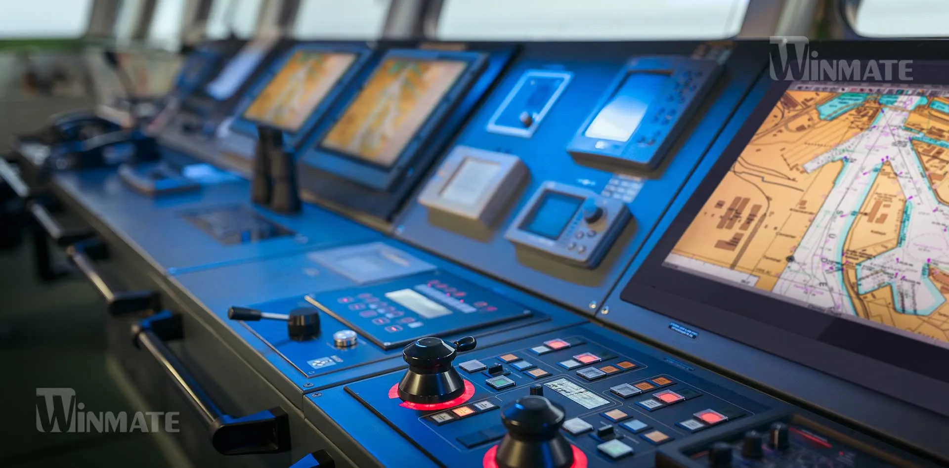
The Electronic Chart Display and Information System (ECDIS) has transformed navigation from paper charts and parallel rulers into digital layers of information. Today, almost every SOLAS-class vessel depends on ECDIS for voyage planning and execution. However, technology does not replace seamanship. It reshapes it. Good ECDIS route planning is like drawing a safe path on a living map that changes with tides, weather, traffic, and human decisions.
This article explains ECDIS route planning best practices for safe navigation in clear and global English. It connects international regulations, bridge team reality, and practical techniques used by professional mariners worldwide.
Why This Topic Matters for Maritime Operations
Modern shipping moves over 80% of global trade by volume. Each voyage carries economic value, environmental risk, and human responsibility. When a vessel grounds or collides, consequences reach far beyond the bridge. They affect coastal communities, insurers, charterers, and ecosystems.
ECDIS sits at the center of this safety chain. According to the International Maritime Organization, ECDIS is now a primary means of navigation under SOLAS Chapter V. Yet accident investigations by authorities such as the Marine Accident Investigation Branch and the European Maritime Safety Agency show that many incidents involve incorrect route planning, unsafe safety contour settings, or blind trust in automation.
In simple terms, poor ECDIS route planning turns a smart system into a dangerous one. Good route planning turns technology into a true safety partner.
Key Developments, Technologies, and Core Principles
Evolution of ECDIS from Support Tool to Primary Navigator
ECDIS did not start as a replacement for paper charts. It began as a decision-support system. Over time, amendments to SOLAS and IMO performance standards made ECDIS a chart carriage option. Today, vessels operate in ECDIS-only mode, using official Electronic Navigational Charts (ENCs) issued by hydrographic offices.
This change increased efficiency but also risk. With paper charts, navigators physically traced routes and noticed hazards. With ECDIS, a route can be drawn in seconds. The danger is that speed can replace thinking. The solution is not to slow down technology, but to deepen understanding.
The Role of ENCs and Chart Data Quality
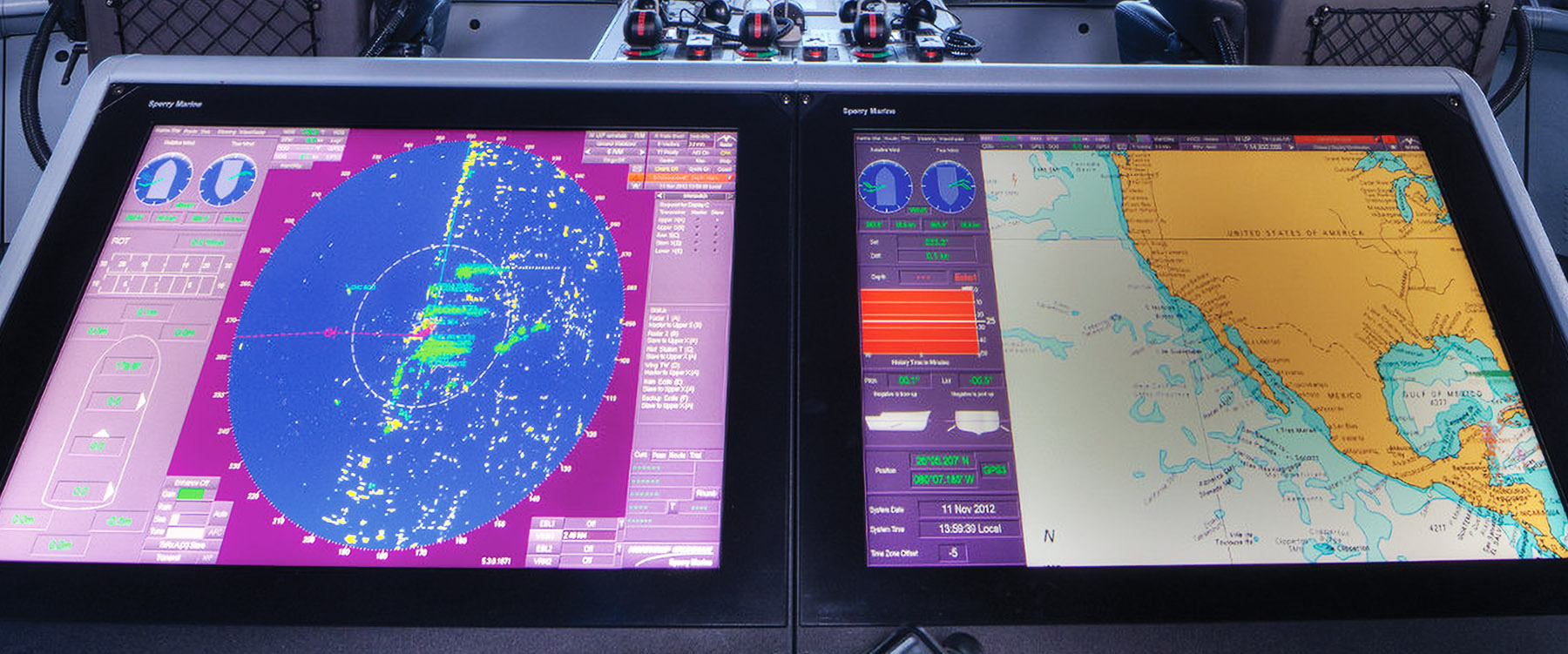
An ENC is only as good as the data behind it. Some coastal areas still rely on surveys made decades ago. Mariners must understand that a blue area on the screen does not always mean safe water. ECDIS presents accuracy categories such as CATZOC (Category Zone of Confidence). These indicate how reliable the depth data is.
A useful analogy is a weather forecast. If the forecast says “70% confidence,” you carry an umbrella. If CATZOC shows poor data, you carry extra margin in your route planning.
Professional route planning always checks:
-
Source and age of survey data
-
Compilation scale of the ENC
-
Over-sounding and isolated dangers
These checks transform ECDIS from a static map into a risk-aware system.
Safety Contours, Safety Depth, and Safety Frames
Among all ECDIS settings, the safety contour is the most critical. It defines the boundary between safe and unsafe water. If it is set incorrectly, the system will not warn about shallow areas.
Best practice is to calculate safety depth based on:
-
Vessel draught
-
Squat at planned speed
-
Tidal variation
-
Wave response allowance
-
Company under-keel clearance policy
For example, a tanker with 12.0 m draught, 1.0 m squat, and 1.0 m safety margin should never plan a route across the 14 m contour. The ECDIS safety contour should reflect this calculation, not a default factory setting.
Safety frames (look-ahead time or distance) must also be adjusted to match vessel speed and area. In confined waters, short frames allow early warning. In ocean passages, longer frames prevent late alarms.
Human-Centered Route Planning
ECDIS was designed to support humans, not replace them. The bridge team must remain the decision-maker. This principle is known as Human-Centered Design, and it is reinforced in IMO guidance and STCW training requirements.
Good route planning uses ECDIS as:
-
A visual planner
-
A risk detector
-
A cross-check tool
It should never become:
-
A blind autopilot
-
A substitute for lookout
-
A replacement for situational awareness
In practical terms, this means planning the route with full chart layers displayed, then simplifying the screen for monitoring during execution.
Best Practices in ECDIS Route Planning
Start with Strategic Voyage Planning
Route planning begins long before touching the ECDIS track line. It starts with understanding the voyage purpose: commercial schedule, cargo type, seasonal weather, and regulatory constraints such as Traffic Separation Schemes (TSS) and emission control areas.
A master planning a winter North Atlantic crossing will choose a different route from a summer voyage. Heavy weather avoidance, wave height limits for container stacks, and fuel efficiency all influence the strategic route.
ECDIS supports this stage by allowing:
-
Alternative routes
-
Distance and time comparison
-
Overlay of weather routing data
However, strategic planning remains a human judgment, not a software calculation.
Layer Management and Information Overload
One of the biggest ECDIS risks is clutter. Too many layers hide hazards. Too few layers hide context. Best practice is to:
-
Display soundings, contours, and dangers during planning
-
Activate additional layers (currents, AIS, weather) only when needed
-
Use consistent color palettes
Think of ECDIS like night driving. High beams show more detail, but they can also blind you. Good navigators adjust brightness and layers according to the situation.
Route Check and System Validation
After drawing the route, professional navigators run an automated route check. This function scans the planned track against ENC data and highlights dangers.
But a route check is not a guarantee. It only finds what exists in the chart database. Therefore, best practice is:
-
Run route check with safety contour activated
-
Manually zoom along the entire route
-
Compare with sailing directions and pilot books
This dual approach mirrors aviation practice, where pilots combine automated flight planning with visual chart review.
Tidal Planning and UKC Management
Under-keel clearance (UKC) is dynamic, not static. It changes with tide, squat, and speed. In shallow approaches, ECDIS should be used with tidal overlays or external tidal software.
A real-world example comes from Australian ports, where deep-draught bulk carriers use dynamic UKC systems approved by the Australian Maritime Safety Authority. These systems integrate ECDIS data with real-time tide and wave sensors.
For most ships, simpler practice applies:
-
Identify minimum charted depth
-
Apply tide corrections
-
Adjust speed for squat
ECDIS allows this information to be visualized, but the calculation still requires professional logic.
Integration with Radar and Visual Bearings
ECDIS route planning should not exist in isolation. It must match radar navigation and visual pilotage plans. Routes should follow:
-
Natural channel alignment
-
Buoyed fairways
-
Radar conspicuous features
This ensures that during execution, the OOW can cross-check between:
-
Radar range and bearing
-
Visual marks
-
ECDIS position
When all three agree, confidence is high. When they disagree, caution must increase.
Challenges and Practical Solutions
One major challenge in ECDIS route planning is over-reliance on automation. Many accidents happen not because ECDIS failed, but because humans trusted it too much. The solution is continuous training and standardization.
Another challenge is inconsistent manufacturer interfaces. Each ECDIS brand uses different menus and symbols. A navigator trained on one system may misinterpret another. Industry bodies such as International Chamber of Shipping and International Association of Classification Societies promote type-specific training to reduce this risk.
A third challenge is ENC updating discipline. An outdated chart can be more dangerous than no chart at all. Best practice is:
-
Weekly official updates
-
Update verification
-
Logging of corrections
In busy operations, this task is sometimes rushed. Companies that treat updating as routine clerical work often experience navigation errors. Companies that treat it as safety-critical work build safer cultures.
Case Studies and Real-World Applications
Grounding in Confined Waters
A bulk carrier grounded in a narrow channel despite having ECDIS. Investigation showed that the safety contour was set to 10 m, while the ship required 12.5 m. The route passed legally but unsafely over a shallow bank. No alarm sounded because the system was told the water was safe.
This case shows that ECDIS only protects what you tell it to protect.
Successful Use in Heavy Traffic
In contrast, a Ro-Ro vessel navigating the English Channel used ECDIS route planning combined with AIS and radar overlays. The route was adjusted slightly offshore to avoid fishing density and cross-channel traffic. The master reported reduced workload and better collision avoidance margins.
Here, ECDIS acted like a traffic control map, improving strategic awareness.
Future Outlook and Maritime Trends
ECDIS is evolving toward integrated navigation systems. Future developments include:
-
High-density bathymetry
-
Real-time tidal correction
-
Machine-learning route optimization
The World Maritime University and industry research partners are studying how artificial intelligence can assist voyage planning. Yet, most experts agree that the human navigator will remain central. Automation may suggest, but humans must decide.
Another trend is cybersecurity. As ECDIS connects to networks, protection against data manipulation becomes part of safe navigation. Classification societies such as DNV and Lloyd’s Register now include cyber risk in ship safety frameworks.
FAQ Section
1. What is the most important ECDIS route planning setting?
The safety contour is the most critical setting because it defines what the system considers unsafe water.
2. Can ECDIS replace paper charts completely?
Yes, if it meets SOLAS requirements and uses official ENCs, but it must be supported by proper training and procedures.
3. Why do accidents still happen with ECDIS?
Most accidents occur due to incorrect settings, poor route planning, or over-reliance on automation.
4. How often should ENCs be updated?
At least weekly, using official update services from hydrographic offices.
5. Is radar still needed if ECDIS is available?
Yes. Radar provides independent position and target information and is essential for cross-checking.
6. What training is required for ECDIS use?
IMO requires generic and type-specific ECDIS training under STCW.
Conclusion and Take-Away
ECDIS route planning is not about drawing a line on a screen. It is about building a safe story for the ship’s journey. The navigator must combine digital tools with human judgment, local knowledge, and professional discipline.
When used correctly, ECDIS becomes a bridge team’s strongest ally. When used carelessly, it becomes a silent risk. The difference lies in planning quality, settings awareness, and continuous learning.
For maritime professionals and students alike, mastering ECDIS route planning best practices for safe navigation is not only a technical skill. It is a safety culture in action.
References
-
International Maritime Organization (IMO). SOLAS Chapter V and ECDIS Performance Standards. https://www.imo.org
-
Marine Accident Investigation Branch (MAIB). Bridge Watchkeeping Safety Studies. https://www.gov.uk/maib
-
European Maritime Safety Agency (EMSA). ECDIS Guidance and Training. https://www.emsa.europa.eu
-
International Chamber of Shipping (ICS). Bridge Procedures Guide. https://www.ics-shipping.org
-
International Association of Classification Societies (IACS). Navigation Safety Guidelines. https://iacs.org.uk
-
Australian Maritime Safety Authority (AMSA). Dynamic UKC and Port Safety. https://www.amsa.gov.au
-
DNV. Cyber Security and Integrated Navigation Systems. https://www.dnv.com
-
Lloyd’s Register. Navigation and Digital Risk Management. https://www.lr.org