
Communication at sea has always been the lifeline of maritime operations. From distress alerts to weather routing, from collision avoidance to routine port calls, ships depend on reliable communication systems to sail safely and efficiently. In today’s digital era, maritime communication technology merges radio, satellite, digital data, and automated monitoring into a single interconnected ecosystem.
Reliable communication is not just a technical feature—it is a regulatory requirement and a fundamental pillar of maritime safety. According to the International Maritime Organization (IMO), failures in communication contribute to a significant proportion of navigational accidents, including collisions, groundings, and delayed distress responses.
Modern ships also operate in congested waters, rely on digital reporting systems, exchange constant data with ports, and interact with global logistics chains. Communication systems enable:
- Distress alerts and search-and-rescue coordination
- Collision avoidance with other ships
- Weather and navigational warnings
- Port operations and clearance procedures
- Cargo, engineering, and safety coordination between departments
- Remote inspections by classification societies such as DNV, ABS, Lloyd’s Register, and RINA
- Cyber-secure data exchange for smart ships and autonomous systems
UNCTAD reports that over 80% of global trade moves by sea, meaning communication failures can have massive economic and safety consequences.
–
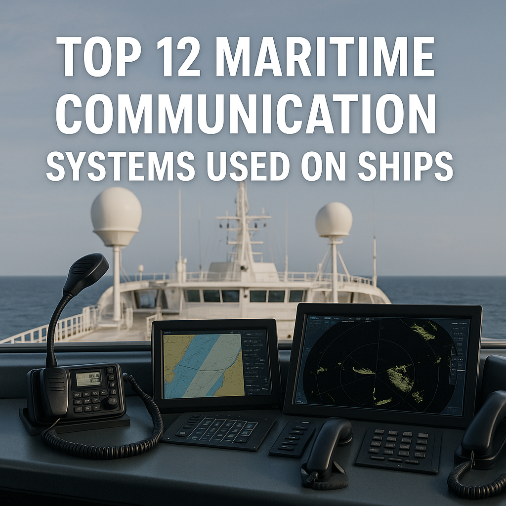
Top 12 Maritime Communication Systems Used on Ships
Below are the most important communication systems used on commercial ships, naval vessels, offshore platforms, and large yachts—each explained in clear, practical language.
1. VHF Marine Radio (Very High Frequency)
VHF Marine Radio serves as the fundamental system for short-range maritime communication. Operating on frequencies between 156 and 174 MHz, it is a mandatory fixture on SOLAS-compliant vessels and is ubiquitously used for critical day-to-day interactions. These include direct ship-to-ship communication for collision avoidance, contact with shore-based facilities like port control and Vessel Traffic Services (VTS), and the broadcast of distress and safety calls on the dedicated Channel 16. Its enduring importance lies in being the fastest and most reliable method for establishing voice contact in coastal waters and congested sea lanes, making it an indispensable tool for maritime safety and operational coordination.
VHF radio is the backbone of short-range maritime communication. Operating between 156–174 MHz, it is mandatory under SOLAS and widely used for:
- Ship-to-ship communication (collision avoidance, passing arrangements)
- Ship-to-shore communication (port control, VTS, harbours)
- Distress and safety calls via Channel 16
- Bridge team coordination during manoeuvring
Why it’s essential:
VHF radio remains the fastest and most reliable way to communicate in coastal waters and crowded shipping lanes. Even with satellites, the maritime industry relies on VHF every day.
2. MF/HF Radio (Medium & High Frequency)
MF/HF Radio provides the capability for long-distance communication beyond the line-of-sight range of VHF by utilizing skywave propagation, which bounces signals off the ionosphere. This technology allows ships to maintain contact across oceans, send digital distress alerts, and receive vital weather and navigational warnings. As a cornerstone of the GMDSS for areas A2 and A3, MF/HF systems offer a robust and independent long-range communication method that does not rely on satellite infrastructure, providing a crucial layer of redundancy for safety at sea.
MF/HF radio extends communication to long distances using skywave propagation. Ships use MF/HF sets (like 2187.5 kHz for DSC alerts) to:
- Communicate across oceans
- Send digital distress alerts
- Receive weather and navigational warnings
- Maintain emergency backup communication if satellite systems fail
HF radio played a central role in early maritime communication and continues to be required under GMDSS Area A2/A3.
Why it’s essential:
It provides long-range redundancy independent of satellites—crucial for safety.
3. GMDSS (Global Maritime Distress and Safety System)
The Global Maritime Distress and Safety System (GMDSS) is an comprehensive international framework established by the IMO to revolutionize maritime emergency response. It integrates a suite of technologies—including VHF/MF/HF DSC, satellite communications, NAVTEX, EPIRBs, and SARTs—into a cohesive and automated alerting network. The system is designed to ensure that a vessel in distress can rapidly notify Search and Rescue Coordination Centres (RCCs) and nearby ships, regardless of location or environmental conditions, thereby dramatically improving the chances of survival in an emergency.
GMDSS is the international standard for maritime emergency communication. Introduced by the IMO, it integrates multiple technologies into a coordinated distress, safety, and alerting system. GMDSS includes:
- VHF DSC
- MF/HF DSC
- INMARSAT satellite terminals
- NAVTEX
- EPIRB
- SART/RLS
- Search and Rescue coordination (RCCs)
Why it’s essential:
GMDSS ensures that any ship in distress can send an automated alert instantly, improving survival chances in emergencies.
4. INMARSAT Satellite Communication Systems
INMARSAT is a leading provider of global maritime satellite communications, delivering a range of services for safety, operational efficiency, and crew welfare. Its offerings include voice and data services through FleetBroadband and high-speed connectivity via Fleet Xpress, while the Inmarsat-C terminal is a mandatory GMDSS component for global ocean regions. These systems enable everything from email and voice calls to weather routing, electronic chart updates, and digital reporting, ensuring ships remain connected and efficiently managed anywhere on the globe, excluding the extreme polar regions.
INMARSAT provides global maritime satellite communication for safety, operations, and crew welfare. Its services include:
- FleetBroadband
- Fleet Xpress (Ka-band)
- Inmarsat-C (mandatory for GMDSS Area A3)
- SafetyNET (navigational and meteorological warnings)
Satellite communication enables:
- Voice calls
- Weather routing
- Electronic chart updates
- Remote diagnostics
- Digital reporting to port authorities
Why it’s essential:
INMARSAT ensures ships stay connected anywhere outside the polar regions.
5. Iridium Satellite Communication
Iridium distinguishes itself as the first and only mobile satellite network to offer truly global coverage, including the crucial polar regions where other systems have gaps. With its constellation approved for GMDSS, Iridium terminals provide reliable distress alerting, safety voice calls, and maritime safety information across the entire planet. Beyond safety, services like Iridium Certus deliver broadband connectivity that supports the Internet of Things (IoT), smart ship platforms, and secure data transfer, making it vital for modern and high-latitude navigation.
Iridium is the first fully global mobile satellite network, including the polar regions—an advantage over INMARSAT. Iridium GMDSS terminals provide:
- Distress alerts
- Safety voice calls
- Maritime safety information (MSI)
Other systems like Iridium Certus offer broadband connectivity for:
- IoT devices
- Smart ship platforms
- Cyber-secure data transfer
- Ice navigation reporting
Why it’s essential:
It is the only global satellite network approved for GMDSS everywhere on Earth, including the Arctic and Antarctic.
6. AIS (Automatic Identification System)
The Automatic Identification System (AIS) is an automated tracking system that broadcasts a vessel’s static and dynamic information, such as identity, position, course, and speed. Primarily used to enhance situational awareness and collision avoidance, it comes in Class A (for SOLAS vessels) and Class B (for smaller craft) versions. AIS also includes specialized beacons like the AIS-SART for man-overboard situations. By acting as a digital visibility beacon, AIS allows vessels and VTS operators to “see” each other electronically, significantly improving safety in crowded waterways.
AIS automatically broadcasts a ship’s identity, course, speed, destination, and other data. It improves visibility and situational awareness for all vessels. Types of AIS:
- Class A – mandatory for SOLAS ships
- Class B – used by smaller vessels
- AIS-SART – for man-overboard and survival craft
- Satellite AIS – global monitoring
AIS helps prevent collisions, enhances VTS monitoring, and supports global maritime analytics.
Why it’s essential:
It acts like an automatic digital “visibility beacon,” allowing ships to see each other even in poor visibility.
7. NAVTEX
NAVTEX is an international, automated system for disseminating navigational and meteorological warnings, as well as urgent maritime safety information. It broadcasts on 518 kHz for international messages and 490 kHz for national languages, providing a vital text-based service to ships in coastal and regional waters. As a mandatory component of GMDSS for areas A1 and A2, it serves as a fundamental “maritime newswire,” delivering critical updates on hazards, weather, and search and rescue information directly to the bridge.
NAVTEX is an automated system that broadcasts navigational warnings, SAR information, weather forecasts, and urgent maritime safety alerts. Received on 518 kHz (international) or 490 kHz (national), NAVTEX is essential for:
- Severe weather warnings
- Coastal navigation hazards
- Security advisories
- SAR reports
It is mandatory for GMDSS Areas A1 and A2.
Why it’s essential:
It functions as the maritime “newswire” for safety-critical messages.
8. EPIRB (Emergency Position-Indicating Radio Beacon)
The Emergency Position-Indicating Radio Beacon (EPIRB) is a critical, life-saving device designed for ultimate emergencies. When activated, either manually or automatically upon water contact, it transmits a powerful distress signal via the international COSPAS-SARSAT satellite system. This signal relays the vessel’s identity and precise GPS location to search and rescue authorities, enabling a rapid response. Modern EPIRBs often include features like Return Link Service, which provides an acknowledgment to survivors, and integrated AIS to alert nearby vessels directly.
EPIRB is the most vital emergency beacon for life-saving at sea. When activated (automatically or manually), EPIRBs:
- Transmit distress signals via COSPAS-SARSAT satellites
- Share GPS position
- Send ship identity (MMSI)
- Enable fast locating by SAR authorities
Modern EPIRBs include:
- Return Link Service (RLS): sends acknowledgment that help is on the way
- AIS capability: shows beacon position on nearby ships’ radars/ECDIS
Why it’s essential:
It can save lives even if all other communication systems fail.
9. SART & AIS-SART (Search and Rescue Transponders)
Search and Rescue Transponders (SARTs) are dedicated devices carried on survival craft to help rescuers locate them in an emergency. The traditional radar-SART, when activated, creates a series of distinctive dots on a rescuing vessel’s radar screen. The newer AIS-SART transmits a precise GPS position via the AIS network, displaying the beacon’s location directly on electronic charts or radar displays. Both systems are mandatory on SOLAS ships and are instrumental in guiding rescuers accurately to lifeboats or persons in the water, especially in poor visibility or rough seas.
SART transponders assist in locating survival craft during emergencies. When triggered, they respond to radar signals and appear as a line of dots on a rescue ship’s radar. AIS-SART is the newer version, transmitting precise GPS location via AIS. Both systems:
- Improve rescue accuracy
- Speed up survivor detection
- Are mandatory on SOLAS ships
Why it’s essential:
It guides rescuers directly to lifeboats or rafts—even in rough seas.
10. LRIT (Long-Range Identification and Tracking)
The Long-Range Identification and Tracking (LRIT) system is a global security and monitoring measure mandated by the IMO for certain classes of ships, including passenger vessels and large cargo ships. It automatically transmits the ship’s position at regular intervals to its Flag State, with data also available to Coastal and Port States under specific circumstances. This system enhances maritime domain awareness, supporting anti-piracy, security, and environmental protection efforts by providing authorities with a reliable means of tracking vessels on a global scale.
LRIT is a global ship tracking system required by IMO for:
- SOLAS passenger ships
- Cargo ships ≥300 GT
- Mobile offshore drilling units (MODUs)
LRIT reports ship position every 6 hours to:
- Flag states
- Coastal states (within 1,000 nm)
- Port states
It enhances maritime security, anti-piracy operations, and environmental monitoring.
Why it’s essential:
It acts as the long-distance “security tracking system” for the global fleet.
11. Internal Communication Systems (PA, Talkback, Intercom, Engine Control Room Systems)
Effective communication within a ship is as critical as external links for safe and efficient operations. A suite of internal systems facilitates this, including Public Address (PA) systems for general announcements, sound-powered telephones that operate without external power for emergency use, and dedicated intercoms between the bridge and engine control room. Additionally, UHF handheld radios, Bridge Navigational Watch Alarm Systems (BNWAS), and talkback systems during complex maneuvers like mooring ensure clear and reliable coordination among the crew at all times.
Communication on ships is not only external. Internal systems maintain smooth crew operations and emergency coordination. These include:
- Public Address (PA) systems
- Sound-powered telephones for emergencies
- Engine Room – Bridge intercom systems
- BNWAS alarms
- UHF hand-held radios
- Talkback systems during mooring and cargo operations
Engineers also use condition monitoring communication tools integrated with systems from makers like Wärtsilä, MAN Energy Solutions, Kongsberg, and Alfa Laval.
Why it’s essential:
Internal communication prevents accidents and ensures all crew members receive coordinated instructions.
12. Internet & Broadband Communication on Ships (VSAT, 4G/5G, Starlink Maritime)
The modern maritime industry has undergone a digital transformation, becoming profoundly dependent on high-speed internet and robust broadband connectivity. This shift has been accelerated over the past five years by the evolution of traditional VSAT systems, the expansion of coastal 4G and 5G networks, and the disruptive entry of global low-earth-orbit services like Starlink Maritime. This connectivity is the central nervous system for contemporary shipping, enabling everything from crew welfare applications like video calls and streaming to critical operational functions. These include remote inspections by classification societies, cloud-based compliance reporting for regulations such as EU MRV and FuelEU Maritime, real-time predictive analytics for maintenance and fuel optimization, and the seamless updating of electronic charts and navigation software. Furthermore, this digital reliance necessitates robust cybersecurity measures as mandated by IMO guidelines. Ultimately, stable, fast, and secure broadband is no longer a luxury but an essential utility that underpins safety, efficiency, and the very future of autonomous shipping experiments.
Modern ships rely heavily on digital connectivity. In the last 5 years, maritime broadband has transformed due to:
- VSAT Ku/K-band systems
- 4G/5G coastal connectivity
- Starlink Maritime (global high-speed satellite internet)
- Remote inspections by classification societies
- Cloud-based reporting for EU MRV, IMO DCS, and FuelEU Maritime
- Cybersecurity systems required by IMO 2021 guidelines
Broadband supports:
- Crew welfare
- Remote maintenance
- Predictive analytics
- Electronic charts and software updates
- Autonomous ship experiments
Why it’s essential:
Modern maritime operations depend on stable, fast, and cyber-secure internet connectivity.
Challenges and Practical Solutions
1. Interference and Congestion in Busy Waters
In congested areas like the Singapore Strait, VHF channels can become overloaded. This leads to misunderstanding or missed calls.
Solution: Use DSC, specific working channels, and VTS coordination to reduce congestion.
2. Cybersecurity Risks
As GMDSS and satellite systems digitalize, cyber risks increase.
Solution: Implement IMO cyber risk management guidelines (Resolution MSC.428(98)).
3. Equipment Failure or Poor Maintenance
A significant number of detentions under the Paris MoU involve defective communication equipment.
Solution: Routine testing, proper logs, and regular inspections by classification societies.
4. Crew Competence Gaps
Non-native English speakers may misunderstand bridge-to-bridge communication.
Solution: Use Standard Marine Communication Phrases (SMCP) by the IMO.
–
Future Outlook & Trends
The future of maritime communication is being shaped by several converging technological and regulatory trends. A primary driver is the modernisation of the Global Maritime Distress and Safety System (GMDSS) by the IMO, which aims to integrate new satellite providers, digital distress messaging, and e-navigation systems. Concurrently, the emergence of autonomous and remotely operated vessels, as demonstrated by projects like MASSTERLY and the Yara Birkeland, is creating a demand for highly reliable, ultra-stable satellite links with built-in redundancy and sufficient bandwidth for remote control. This surge in connectivity is enabling the use of big data and predictive analytics, allowing for real-time data transmission that facilitates fuel optimisation, advanced engine diagnostics, intelligent weather routing, and automated emission reporting for compliance with regulations like the EU ETS and FuelEU Maritime. To support these data-intensive applications, the industry is moving towards hybrid networks that combine coastal 5G terrestrial networks with satellite systems, delivering higher bandwidth, lower latency, and reduced operational costs. Underpinning all these advancements is an intensified focus on cybersecurity, with future communication systems expected to incorporate encrypted satellite links, quantum-resistant protocols, and real-time cyber threat detection to protect critical ship-to-shore data flows.
–
FAQ Section
1. What is the most important communication system on a ship?
For distress safety, GMDSS is the most important system. For everyday communication, VHF radio is essential.
2. Is AIS mandatory for all ships?
AIS Class A is mandatory for SOLAS ships, while Class B is used for smaller vessels.
3. What is the difference between INMARSAT and Iridium?
INMARSAT covers most of the world except the poles; Iridium provides 100% global coverage including polar regions.
4. What does an EPIRB do?
EPIRB sends an emergency signal and GPS position to satellites, enabling rapid rescue.
5. Can ships use normal mobile phones at sea?
Only near coastlines. Offshore areas require satellite communication.
6. How often are communication systems inspected?
Annually by classification societies; daily/weekly tests must be logged onboard.
7. Why does maritime English matter?
SMCP reduces misunderstandings and supports global communication among multinational crews.
–
Conclusion
Maritime communication systems are the backbone of modern navigation, safety, and global shipping logistics. From VHF radios to satellite broadband, each system plays a unique and irreplaceable role in keeping ships connected—whether during routine port calls or life-saving emergencies in the open ocean.
As maritime technology evolves with digitalization, autonomous systems, and enhanced satellite networks, communication will continue to expand beyond traditional radio and into a fully integrated digital ecosystem.
For students, cadets, and industry professionals, mastering these systems is essential for safe navigation and professional growth. The future of maritime communication promises more automation, better coverage, stronger cybersecurity, and improved safety—making seafaring safer and more connected than ever.
References
International Maritime Organization (IMO) https://www.imo.org
UNCTAD Maritime Transport Review https://unctad.org
COSPAS-SARSAT https://www.cospas-sarsat.int
IALA AIS Guidelines https://www.iala-aism.org
Inmarsat Maritime https://www.inmarsat.com/maritime
Iridium Maritime https://www.iridium.com
Starlink Maritime https://www.starlink.com/maritime
MAIB Accident Reports https://www.gov.uk/maib-reports
Paris MoU on Port State Control https://www.parismou.org
Lloyd’s Register (LR) https://www.lr.org
DNV Maritime https://www.dnv.com/maritime
RINA https://www.rina.org
ClassNK https://www.classnk.or.jp
Wärtsilä Marine https://www.wartsila.com/marine
MAN Energy Solutions https://www.man-es.com
Kongsberg Maritime https://www.kongsberg.com/maritime