
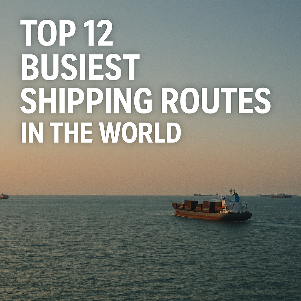
Discover the top 12 busiest shipping routes in the world—the true arteries of global trade. Explore where traffic is densest, why these corridors matter to prices and supply chains, and how technology, geopolitics, and decarbonisation are reshaping the sea lanes in 2025.
Why sea lanes still decide what we pay, eat, and build
Open your cupboard and pick any product—coffee, smartphones, medical supplies, even the fertilizer that grew last season’s wheat. Odds are, it sailed at least part of the way to you. Maritime transport carries the overwhelming majority of global trade by volume, and it does so along remarkably concentrated pathways. These aren’t just lines on a map. They are living arteries that pulse with container ships, bulkers, tankers, car carriers, LNG and LPG vessels, and more. When one of these arteries clogs or reroutes—because of a drought at a canal, a war near a chokepoint, or a ship stuck sideways—the shock travels everywhere: shelves thin out, freight rates spike, and the world is reminded how interconnected it is.
In 2025, understanding the busiest shipping routes means understanding the world economy. Container alliances plan loops and rotations around them; energy markets hinge on their security; insurers and classification societies calibrate risk and standards to their realities; and decarbonisation strategies from ports to shipowners are designed with these corridors in mind. This guide walks you through the twelve most trafficked sea routes, explaining what flows along them, which chokepoints define them, and how new technologies and rules are changing the way ships move.
How busiest shipping routes shape modern maritime operations
Shipping routes concentrate demand and risk. Carriers seek high-density corridors to maximise vessel utilisation; ports invest in deeper channels and bigger cranes where loops converge; regulators and navies focus surveillance and response assets around chokepoints; and technology vendors deploy pilots—digital twins, just-in-time arrival systems, e-navigation—where benefits scale fastest. Freight indices, bunker fuel strategies, and even ship design (draft, beam, fuel flexibility) are tuned to the constraints and opportunities of these arteries.
Three dynamics define the busiest routes in 2025:
-
Economies of scale and network effects. The more cargo a corridor aggregates, the more carriers deploy larger ships and tighter schedules, which in turn attracts more cargo.
-
Chokepoint sensitivity. Narrow straits and canals compress traffic and introduce systemic risk. A single incident can ripple through markets for months.
-
Regulatory and environmental pressures. Emission rules (IMO, EU ETS), energy transition cargoes (LNG, critical minerals), and climate impacts (canal water shortages, extreme weather) are actively reshaping routing decisions and speeds.
The Top 12 busiest shipping routes in 2025
How to read these profiles: Each route blends container, bulk, and tanker flows; each has dominant commodities, defining chokepoints, and a distinct risk/technology profile. All intertwine with the others, which is why a disruption in one often reconfigures traffic everywhere.
1) Asia–Europe mainline via the Strait of Malacca and Suez Canal
This is the archetypal long-haul container artery. It links manufacturing powerhouses in East Asia (China, South Korea, Japan, Vietnam) with European consumer and industrial markets. Vessels funnel from the South China Sea through the Strait of Malacca to Singapore, then west across the Indian Ocean to the Bab el-Mandeb and Red Sea, through the Suez Canal, and onward to the Mediterranean and North Europe (Rotterdam, Antwerp-Bruges, Hamburg, Felixstowe).
Why it’s so busy: Sheer container volumes and high-value goods; tight port clusters at both ends; and competitive schedules run by the largest alliances. Energy and bulk cargoes also use Suez, but container loops dominate the corridor’s rhythm.
Risk and resilience: The route is acutely sensitive to Suez incidents and Red Sea security. Weather is relatively benign compared with the North Pacific, but a single canal delay can stack up days of waiting. Diversions via the Cape of Good Hope swing tens of thousands of nautical miles of extra steaming across the global fleet, changing voyage economics overnight.
2025 lens: Security-driven diversions have pushed some carriers around the Cape, forcing longer transit times, higher fuel burn, and revised schedule reliability. Ports at both ends respond with more flexible berthing windows and just-in-time (JIT) arrival pilots.
2) Transpacific Eastbound: Asia to North America’s West Coast
From Chinese coastal hubs, Busan, Yokohama, and emerging Southeast Asian load ports, container ships surge across the North Pacific to Los Angeles/Long Beach, Oakland, Prince Rupert, Vancouver, and Seattle/Tacoma. The corridor moves consumer electronics, apparel, furniture, auto parts, and increasingly e-commerce volumes.
Why it’s so busy: North America’s largest consumer market sits across the shortest Pacific path from Asia’s factories. Intermodal railheads and vast distribution centres amplify the corridor’s pull.
Risk and resilience: Seasonal weather can be brutal with Pacific storms and long swells. Port labour negotiations, rail congestion, and California’s emissions rules influence speeds, equipment choices, and port calls. Shippers sometimes reroute via the Panama Canal to the US East/Gulf Coasts when West Coast congestion or labour risks rise.
2025 lens: Infrastructure upgrades, expanded on-dock rail, and zero-emission cargo-handling roadmaps aim to keep velocity high while meeting air-quality and climate targets.
3) Transatlantic: Northern Europe to North America (both directions)
Shorter than the two giants above but dense and diversified, this artery carries containers, refined products, chemicals, machinery, and autos between core European gateways (Rotterdam, Antwerp-Bruges, Hamburg, Bremerhaven, Le Havre) and US East Coast ports (New York/New Jersey, Norfolk, Savannah, Charleston), plus Canadian hubs (Halifax, Montreal).
Why it’s so busy: Balanced trade baskets, stable demand, and strong liner service frequency. It is also crucial for energy trade realignment, with refined products and LNG repositioning since 2022.
Risk and resilience: North Atlantic winters stress hulls and schedules; ice in certain seasons affects Canadian approaches. ETS costs on the European side and fuel strategies (VLSFO, LNG, biofuels) factor into pricing.
2025 lens: The corridor benefits from near-shoring trends and resilient consumer demand. Green corridor pilots (cleaner fuels, aggregated shore power) are maturing here thanks to policy support on both sides.
4) Intra-Asia network: the densest web you don’t see on world maps
While long-haul lanes get headlines, Intra-Asia is arguably the world’s busiest network by ship calls and port pairs. Short-sea container ships stitch together the Pearl River Delta, Yangtze River system, Bohai Rim, Japan/Korea rings, and Southeast Asian ports (Ho Chi Minh City, Laem Chabang, Port Klang, Tanjung Priok, Manila) with high-frequency feeders.
Why it’s so busy: Regional supply chains, component trade, and transshipment into long-haul loops. Thousands of weekly sailings keep factories supplied and exports consolidated.
Risk and resilience: Typhoons, port congestion in peak seasons, and draft constraints in river ports. Because legs are short, schedule slippage compounds quickly.
2025 lens: Digital port call optimisation and terminal automation in East and Southeast Asia improve predictability. Expect rapid adoption of alternative fuels on smaller tonnage here (methanol-ready, battery-hybrid feeders).
5) The Strait of Malacca–Singapore corridor: a superhighway in 1.7 nautical miles of breadth
Between Sumatra and the Malay Peninsula, the Strait of Malacca funnels a massive share of East–West trade, with Singapore serving as the beating heart for bunkering, transshipment, and repairs. It is not a “route” alone but the narrowest point through which multiple routes must pass.
Why it’s so busy: Geography is destiny. Malacca is the shortest route from the Indian Ocean to the South China Sea for deep-draft vessels. Singapore’s mega-hub services keep ships moving.
Risk and resilience: High traffic density, shallow patches, and the need for precise traffic separation schemes. Piracy risks have declined over the long term but vigilance is constant.
2025 lens: Expansion of the Tuas Mega Port and widespread port digitalisation (slot booking, real-time berth planning) reduce idle time and anchorages, improving safety and emissions.
6) The South China Sea trunk and Taiwan Strait
From the Pearl and Yangtze river deltas through the South China Sea, routes peel north toward Korea and Japan or east into the Pacific. The Taiwan Strait concentrates north-south flows that connect some of the world’s busiest ports.
Why it’s so busy: It is the core conduit linking China’s industrial coast to regional partners and long-haul lanes. Energy imports and raw materials also transit to North Asia.
Risk and resilience: Monsoon weather, typhoons, dense fishing grounds, and geopolitical tensions require careful passage planning. Vessel Traffic Services and coastal AIS networks are robust, yet situational awareness remains a premium skill.
2025 lens: Enhanced e-navigation and fleet traffic management tools support safer transits. Some carriers hedge geopolitical risk with additional time buffers or alternative routings when tensions rise.
7) Persian Gulf to Asia and Europe: the energy lifeline through the Strait of Hormuz
Crude oil, refined products, LPG, and increasingly LNG flow from the Gulf to Asian buyers (India, China, Japan, Korea) and to Europe via the Strait of Hormuz, one of the world’s most sensitive chokepoints. Fujairah and other hubs anchor bunkering and storage.
Why it’s so busy: Energy demand concentration. Even with diversification, the world relies on Gulf exports, and Asian refiners draw heavily from them.
Risk and resilience: Security incidents, drone/missile threats, and mine risks periodically escalate. Tanker design, convoy practices, and naval presence all mitigate but cannot eliminate the exposure.
2025 lens: Dynamic insurance premiums, heightened vetting, and satellite-aided traffic monitoring are standard. LNG capacity growth adds more high-spec tonnage and scheduling complexity.
8) Panama Canal corridors: Asia–US East/Gulf and west-east inter-Americas
The Panama Canal knits Asia to the US East and Gulf Coasts and connects the Pacific and Atlantic coasts of the Americas. Its Neopanamax locks opened larger economics to containers, LPG, and LNG, while legacy locks remain critical for other cargos.
Why it’s so busy: It saves weeks compared with rounding South America and allocates valuable slots to container strings, gas carriers, and car carriers.
Risk and resilience: Freshwater availability is now a strategic variable. Low rainfall seasons reduce daily transit slots and enforce draft limits, forcing voyage replans, transhipment, or switches back to rail/road combinations across North America.
2025 lens: Water-saving measures and booking reforms continue, but shippers are increasingly adept at agile routing—swinging between Panama, rail land-bridges, or Suez depending on rates, reliability, and seasons.
9) English Channel and North Sea approaches: Europe’s tightest funnel
The Dover Strait and English Channel are among the densest traffic corridors on Earth. Feeder services, cross-Channel ferries, deep-sea container strings, car carriers, product tankers, and offshore wind construction vessels all weave across separation schemes into the North Sea’s major ports.
Why it’s so busy: It is the unavoidable gateway to Northern Europe’s port complex and industrial heartland. Short sea services add relentless frequency.
Risk and resilience: Fog, strong tides, and heavy crossing traffic demand strict adherence to COLREGs and routing. Robust VTS and pilotage keep order, but even minor incidents can cascade into queues.
2025 lens: Shore power roll-outs and ETS compliance push carriers and ports to coordinate berth times more precisely. Offshore wind logistics intensify coastal activity, adding to traffic management demands.
10) Mediterranean–Black Sea corridor via the Turkish Straits
The Dardanelles and Bosphorus connect the Black Sea’s exporters (grain, metals, oil products) with the Mediterranean and beyond. Istanbul’s waterway is narrow, curved, busy, and urban—an extraordinary combination.
Why it’s so busy: Ukraine, Russia, Romania, Bulgaria, Georgia, and Türkiye rely on this outlet. Bulkers and product tankers dominate, with liners and Ro-Ro adding to the mix.
Risk and resilience: Strong surface currents, sharp turns, and urban proximity complicate navigation. Geopolitics can alter inspection regimes and convoy patterns, influencing waiting times and insurance.
2025 lens: Modernised traffic scheduling, tug availability, and mandatory pilotage rules remain critical. Grain corridor agreements, when active, can abruptly reshape traffic density and ship mix.
11) Cape of Good Hope: the long detour that often becomes the main road
When Suez or the Red Sea becomes risky or congested, the Cape route reconnects Asia and Europe via the South Atlantic. It is longer, but for very large crude carriers (VLCCs) and some bulkers, it’s a familiar run even in normal times. For container strings, shifting to the Cape forces network redesigns, extra vessels to maintain weekly frequency, and higher fuel bills.
Why it’s so busy (at times): It is the pressure-release valve for global trade. In some periods, it temporarily absorbs astonishing flows of containerised and energy cargoes.
Risk and resilience: Heavy weather in the Southern Ocean, longer exposure to piracy risk off certain African coasts (historically episodic), and schedule integrity challenges.
2025 lens: Route choice is now a live variable in network planning models, not just a rare contingency. Slow steaming strategies and alternative fuel bunkering points (e.g., South Africa, Namibia) gain attention when this route dominates.
12) US Gulf–Europe energy and chemicals corridor
From Houston, Corpus Christi, and Louisiana terminals, rising exports of crude, refined products, LNG, and petrochemicals cross the Atlantic to Europe. This corridor has grown sharply as energy trade patterns reoriented, with product tankers, LNGCs, and ethane/LPG carriers joining container flows.
Why it’s so busy: Structural energy demand in Europe and competitive US supply, plus a powerful US petrochemical complex tied to domestic gas.
Risk and resilience: Hurricane seasons in the Gulf, pilot/traffic delays at key channels, and winter weather on the North Atlantic. LNG shipping requires narrow scheduling windows at both ends, increasing the premium on port/terminal efficiency.
2025 lens: New export capacity and European regasification add sustained volumes. Emissions compliance and methane slip mitigation shape fleet and fuel choices.
–
Technologies transforming high-density routes
AIS-driven situational awareness and data science. Near-real-time vessel tracking underpins traffic separation, port call optimisation, and predictive ETA models. For carriers, AIS fused with weather routing yields safer, more efficient passages on the Pacific and Indian Oceans.
Just-in-Time (JIT) arrivals and virtual queuing. Ports on the busiest corridors pilot systems that slow ships to meet a precise berth window—cutting fuel use, congestion, and anchorage risks.
Digital twins and port community systems. From Singapore to Rotterdam, integrated platforms share cargo milestones, customs status, berth plans, and tug availability across stakeholders. On bottleneck corridors, minutes matter.
Alternative fuels and energy-efficient tech. LNG, methanol-ready designs, wind-assist, air lubrication, shore power, battery hybrids for short-sea vessels—these are increasingly deployed where traffic is thickest and policy is strongest.
Autonomous support and decision aids. We are not talking about ghost ships. We are talking about smarter human decisions—collision-avoidance advisories, fatigue monitoring, smarter pilotage handoffs—especially valuable in the Channel, Malacca, and Turkish Straits.
Challenges and sensible solutions along the arteries
Canal constraints and climate variability. Water scarcity at Panama and high winds or security constraints around Suez are now recurring business variables, not outliers.
Solution: Diversified routing playbooks, flexible slot bookings, intermodal land bridges, and mixed fleets capable of both canal- and Cape-friendly economics.
Security near chokepoints. From Hormuz to Bab el-Mandeb, risk spikes change insurance, speeds, and watch conditions.
Solution: Updated BMP (Best Management Practices), convoying when required, close liaison with naval authorities, hardened cyber posture, and careful voyage planning.
Congestion and schedule reliability. The densest routes magnify every small delay.
Solution: JIT arrivals, berth window discipline, better rail/terminal sync, and collaborative decision making through port community systems.
Decarbonisation compliance costs. ETS exposure and fuel pathways (VLSFO vs. LNG vs. bio/methanol) influence service strings and port choices.
Solution: Route-specific abatement curves (speed profiles, tech retrofits), green corridor partnerships, and multi-fuel flexibility to arbitrage evolving bunkering networks.
Extreme weather. North Pacific winters, Atlantic storms, and tropical cyclones impose recurring hazards.
Solution: Advanced weather routing, hull/propeller maintenance for heavy weather efficiency, and dynamic safety margins on tight schedules.
Real-world snapshots: when routes reshape the world
A containership aground in a canal. One stuck ship can pause ~12% of global trade flowing through a corridor. The economic lesson: redundancy matters, and “just-in-time” needs “just-in-case.”
A drought limits canal slots. Booking premiums soar; LNG and car carriers elbow for priority; boxes swing to rail across North America or to Suez loops. End-to-end lead times shift by a week or more.
Security flare-ups in the Red Sea. Insurance, war risk premiums, and speed orders change instantly; carriers cascade capacity to the Cape; European importers adjust inventory buffers; ports re-sequence berths.
A bumper harvest in the Black Sea. Suddenly the Turkish Straits face long queues of bulkers. Safety margins tighten, and scheduling discipline becomes everything.
Future outlook: five things to watch
-
Green shipping corridors linking high-policy ports will anchor early fuel transitions and standardised JIT frameworks.
-
Bigger data, smaller margins as ETA accuracy and berth synchronisation wring days out of round voyages.
-
Multi-route resilience becomes a core competitive advantage. Carriers will market agility, not just megaships.
-
Regionalisation and near-shoring will redirect some flows, but the big arteries will still dominate—just with different mixes of goods.
-
Arctic routes will remain niche. Ice, insurance, infrastructure, and environmental risk keep them peripheral for now.
FAQ
What is the single busiest shipping route?
By pure container volume and economic concentration, Asia–Europe via Suez and the Transpacific Asia–US West Coast are the two titans. Intra-Asia, measured by port pairs and frequency, is extraordinarily busy but more distributed.
How are “busiest” routes measured?
Through a mix of metrics: vessel calls, cargo tonnage, TEUs, AIS track density, and the economic value of goods moved. Different cargo segments (containers, bulk, tankers) yield different “busiest” rankings.
Why do diversions around the Cape matter so much?
They add thousands of nautical miles, days of sailing, and hundreds of tonnes of extra fuel per voyage—disrupting schedules, equipment availability, and freight rates worldwide.
Are canals losing importance due to climate and security?
No—but they are becoming more managed and more variable. Shippers bake in alternatives and buffer days. Canal authorities invest in water saving, traffic management, and resilience.
What technologies most improve safety on dense routes?
Modern ECDIS integrated with AIS and weather routing, fatigue/risk decision aids on the bridge, and robust port community systems that cut idle time and anchorage crowding.
Will decarbonisation slow ships down permanently?
Average speeds have already balanced fuel economy with reliability (“smart steaming”). Expect more precise speed control and JIT arrivals rather than blanket slowdowns.
Which chokepoints worry insurers the most?
Suez/Red Sea, Hormuz, Bab el-Mandeb, Panama (for reliability), Turkish Straits, Dover Strait for density—each for different reasons: security, climate constraints, or traffic intensity.
Conclusion: Designing a safer, cleaner future for the world’s arteries
The busiest shipping routes are the world economy in motion—disciplined, data-driven, and sometimes fragile. Their importance isn’t only measured in TEUs or tonnes, but in the predictability they give to farmers, factory planners, port workers, and families everywhere. In 2025, the industry’s challenge is to keep these arteries flowing while cutting emissions, strengthening resilience, and protecting seafarers. That means smarter routing, interoperable port systems, flexible service strings, and pragmatic fuel transitions. Above all, it means treating time and safety as strategic resources. If you work in maritime—or teach future mariners—these routes are your best classroom: they show where the world is going and how it gets there.
If you found this guide useful, explore our companion articles on the world’s major sea routes, global port cities, and man-overboard safety for maritime students and crews.
References
-
International Maritime Organization (IMO) – Conventions, guidance on safety, security, and decarbonisation
-
UNCTAD – Review of Maritime Transport – Annual analysis of seaborne trade and fleet trends
-
International Chamber of Shipping (ICS) – Industry guidance and policy positions
-
European Maritime Safety Agency (EMSA) – Traffic density maps, safety and environmental reports
-
International Association of Ports and Harbors (IAPH) – Port initiatives, sustainability and digitalisation
-
Suez Canal Authority – Official canal information and navigation circulars
-
Panama Canal Authority – Advisories, booking rules, draft notices
-
US Energy Information Administration (EIA) – Global energy flows and maritime chokepoints
-
Lloyd’s Register and DNV – Classification and safety/energy efficiency guidance
-
BIMCO – Contracting standards, security and piracy guidance, market insights
-
MarineTraffic and VesselFinder – AIS visualisations and traffic analytics
-
European Sea Ports Organisation (ESPO) – Port policy, sustainability, shore power and ETS coverage
-
International Group of P&I Clubs – Risk circulars, sanctions and security advisories
-
International Renewable Energy Agency (IRENA) – Energy transition impacts on maritime (for LNG/wind-related logistics)
THANKS